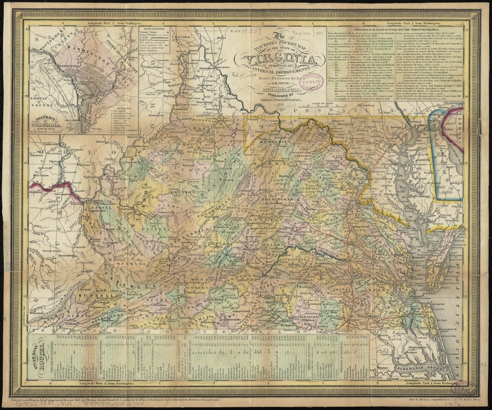
The tourist's pocket map of the state of Virginia : exhibiting its internal improvements, roads, distances &c
Item Information
- Title:
- The tourist's pocket map of the state of Virginia : exhibiting its internal improvements, roads, distances &c
- Title (alt.):
-
Map of the state of Virginia
- Creator:
- Young, J. H. (James Hamilton)
- Name on Item:
-
by J.H. Young.
- Date:
-
1851
- Format:
-
Maps/Atlases
- Location:
-
Boston Public Library
Norman B. Leventhal Map & Education Center - Collection (local):
-
Norman B. Leventhal Map & Education Center Collection
- Subjects:
-
Virginia--Maps
Washington (D.C.)--Maps
- Places:
-
Virginia
District of ColumbiaWashington
- Extent:
- 1 map : hand col. ; 31 x 38 cm.
- Terms of Use:
-
No known copyright restrictions.
No known restrictions on use.
- Publisher:
-
Philadelphia :
Published by Thomas, Cowperthwait & Co. ; Sold by Thomas, Cowperthwait & Co., no. 253 Market Street
- Scale:
-
Scale [ca. 1:2,000,000]
- Language:
-
English
- Notes:
-
Relief shown by hachures.
"Entered according to act of Congress in the year 1851 by Thomas, Cowperthwait & Co. in the clerks office of the district court of the eastern district of Pennsylvania."
Prime meridian: Washington, [D.C.].
Includes tables of "Principal road & stage routes through Virginia" and "Steamboat routes."
Shows county towns, stage roads, canals, and railroads.
Inset: District of Columbia. Scale [ca. 1:250,000]. Includes index.
- Identifier:
-
06_01_010982
- Call #:
-
G3880 1851 .Y68
- Barcode:
-
39999065680744


