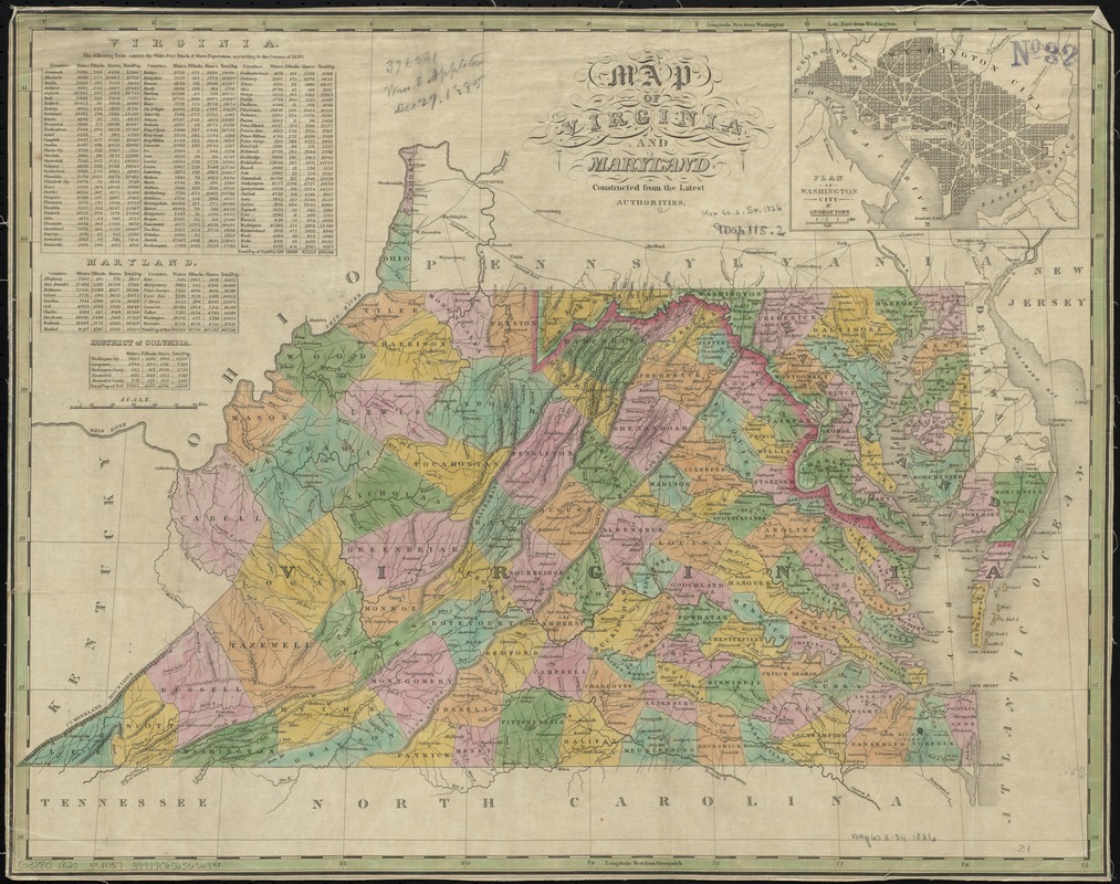
Map of Virginia and Maryland, constructed from the latest authorities
Item Information
- Title:
- Map of Virginia and Maryland, constructed from the latest authorities
- Date:
-
[1820?–1829?]
- Format:
-
Maps/Atlases
- Location:
-
Boston Public Library
Norman B. Leventhal Map & Education Center - Collection (local):
-
Norman B. Leventhal Map & Education Center Collection
- Subjects:
-
Virginia--Maps
Maryland--Maps
Washington (D.C.)--Maps
Georgetown (Washington, D.C.)--Maps
- Places:
-
Virginia
Maryland
District of ColumbiaWashingtonGeorgetown
- Extent:
- 1 map : hand col. ; 42 x 54 cm.
- Terms of Use:
-
No known copyright restrictions.
No known restrictions on use.
- Publisher:
-
Philadelphia? :
Anthony Finley
- Scale:
-
Scale [ca. 1:1,500,000]
- Language:
-
English
- Notes:
-
Relief shown pictorially.
Prime meridians: Washington and Greenwich.
Includes tables of 1820 population statistics.
Inset: Plan of Washington City & Georgetown.
Margins, including imprint, trimmed off.
- Identifier:
-
06_01_008750
- Call #:
-
G3880 1820 .M37
- Barcode:
-
39999065656363


