Map of eastern Virginia
Item Information
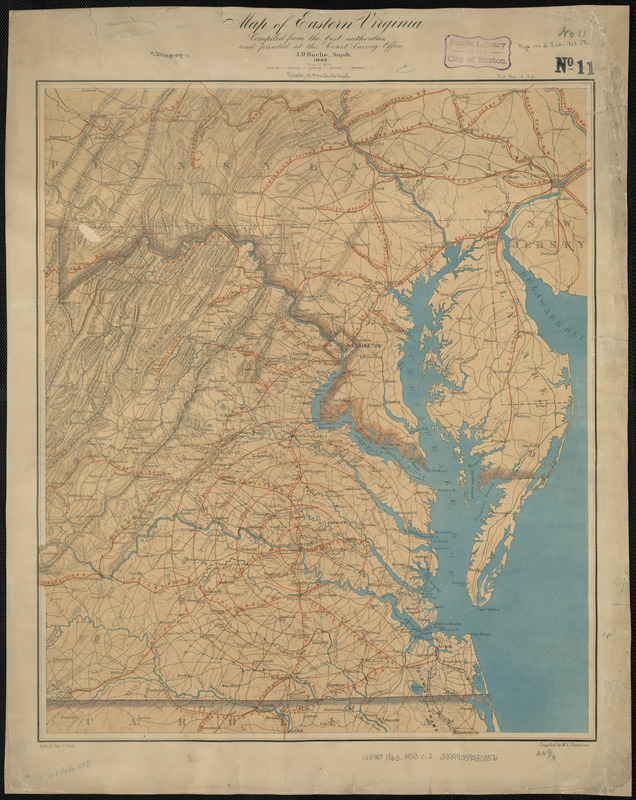
- Title:
- Map of eastern Virginia
- Title (alt.):
-
Eastern Virginia
- Creator:
- Nicholson, W. L.
- Contributor:
- Bache, A. D. (Alexander Dallas), 1806-1867
- Contributor:
- Krebs, Charles G.
- Contributor:
- Hawley, Joseph R. (Joseph Roswell), 1826-1905
- Contributor:
- U.S. Coast and Geodetic Survey
- Name on Item:
-
compiled from the best authorities and printed at the Coast Survey Office, A.D. Bache, supdt. ; compiled by W.L. Nicholson ; lith. by Chas. G. Krebs
- Date:
-
1863
- Format:
-
Maps/Atlases
- Location:
-
Boston Public Library
Norman B. Leventhal Map & Education Center - Collection (local):
-
Norman B. Leventhal Map & Education Center Collection
- Subjects:
-
Virginia--Maps
Maryland--Maps
- Places:
-
Maryland
Virginia
- Extent:
- 1 map : col. ; 56 x 48 cm.
- Terms of Use:
-
No known copyright restrictions.
No known restrictions on use.
- Publisher:
-
[Washington] :
The Office
- Scale:
-
Scale ca. 1:875,000
- Language:
-
English
- Notes:
-
Relief shown by hachures.
Also covers Maryland, and southeastern Pennsylvania.
Shows radial distances from Richmond and Washington, D.C.
In right lower corner: August.
- Identifier:
-
06_01_007658
- Barcode:
-
39999059030856


