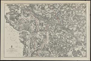
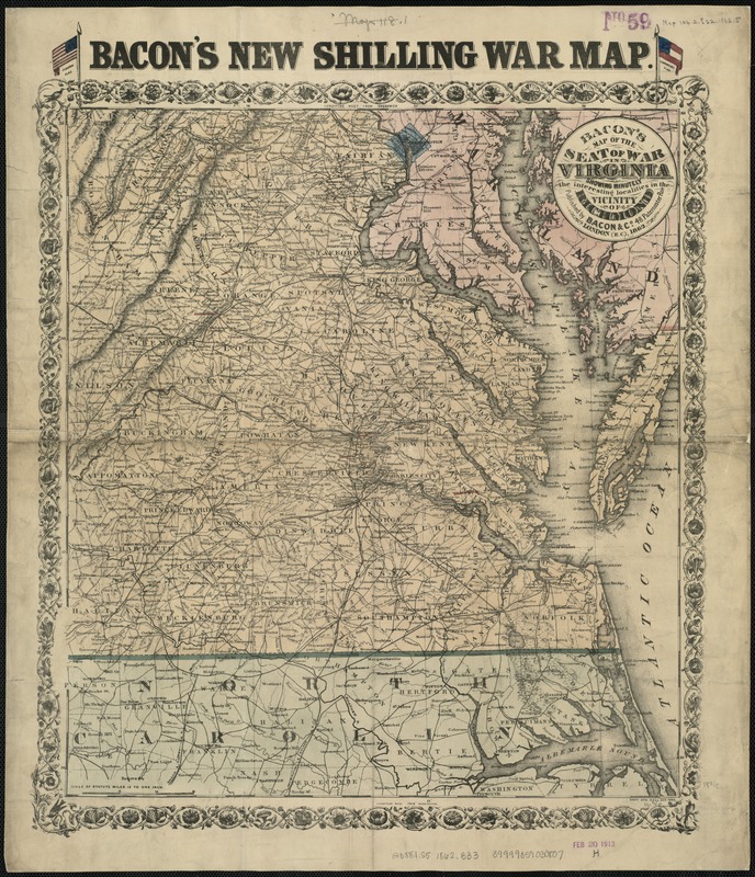
Bacon's Map of the seat of war in Virginia : showing minutely the interesting localities in the vicinity of Richmond
Item Information
- Title:
- Bacon's Map of the seat of war in Virginia : showing minutely the interesting localities in the vicinity of Richmond
- Alternate title :
- Map of the seat of war in Virginia
- Title (alt.) :
- Bacon's New shilling war map
- Creator:
- Bacon & Co
- Date:
-
1862
- Format:
-
Maps/Atlases
- Location:
-
Boston Public Library
Norman B. Leventhal Map & Education Center - Collection (local):
-
Norman B. Leventhal Map & Education Center Collection
- Subjects:
-
Virginia--History--Civil War, 1861-1865--Maps
Virginia--Maps
Richmond (Va.)--Maps
United States--History--Civil War, 1861-1865--Maps
- Places:
-
VirginiaRichmond
- Extent:
- 1 map : hand col. ; 47 x 42 cm.
- Terms of Use:
-
No known copyright restrictions.
No known restrictions on use.
- Publisher:
-
London :
Bacon & Co.
- Scale:
-
Scale [ca. 1:720,000].
- Language:
-
English
- Notes:
-
Relief shown by hachures.
"Entd. Sta. Hall Aug 1862." appears just below neatline at lower right.
Alternate title from upper margin, where it is flanked by Federal and Confederate flags.
Shows area from Albemarle Sound in southeast running northward to Annapolis and west to Staunton.
- Identifier:
-
06_01_007382
- Call #:
-
G3881.S5 1862 .B33
- Barcode:
-
39999059030807