Toggle navigation
LMEC Home
Exhibitions
Georeferencing
Tools for Teachers
Collections
My Favorites
Sign Up / Log In
Search
Search the map portal
Map Collection
Map Collection
Map Sets
Search
Search
Search for
Search In
All Fields
Creator
Title
Subject
Place
Search All Digital Collections
Advanced Search
8162 Results
My Search
Start Over
More Like
commonwealth:ht250769f
Remove constraint More Like: commonwealth:ht250769f
Filter your Search
Place
North and Central America
4,912
United States
3,602
Suffolk (county)
1,026
Boston
999
Europe
963
Canada
427
France
269
Massachusetts
249
more
Place
»
Topic
Boston (Mass.)--Maps
574
United States--Maps
270
Real property--Massachusetts--Boston--Maps
174
Massachusetts--Maps
160
Landowners--Massachusetts--Boston--Maps
132
North America--Maps--Early works to 1800
103
New England--Maps
99
Europe--Maps
78
more
Topic
»
Date
Date range begin
–
Date range end
Current results range from
1482
to
2023
View distribution
Creator
United States. Hydrographic Office
357
O.H. Bailey & Co
148
Des Barres, Joseph F. W. (Joseph Frederick Wallet), 1722-1824
123
United States. Post Office Dept
120
Ptolemy, 2nd cent
100
Walling, Henry Francis, 1825-1888
94
Jefferys, Thomas, -1771
84
Geological Survey (U.S.)
82
more
Creator
»
Format
Maps/Atlases
8,103
Manuscripts
215
Prints
51
Books
36
Objects/Artifacts
10
Drawings/Illustrations
8
Posters
4
Georeferenced
Yes
869
No
7,293
Collection
Norman B. Leventhal Map Center Collection
8,162
Boston and New England Maps
2,184
Urban Maps
1,925
Maritime Charts and Atlases
750
American Revolutionary War-Era Maps
616
Boston Redevelopment Authority Collection
86
Available to use
No known restrictions
8,021
Creative Commons license
46
Search Constraints
Sort by relevance
relevance
title
date (asc)
date (desc)
Number of results to display per page
100 per page
10
per page
20
per page
50
per page
100
per page
View results as:
grid view
map view
Search Results
1.
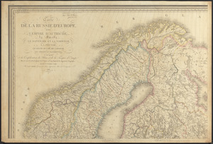
Carte de la Russie d'Europe, avec l'Empire d'Autriche, la Suede, le Danemark et la Norwege, la Prusse, le Grand Duche ́de...
2.
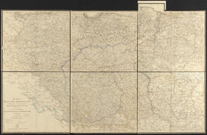
Charte von den Königreichen Preussen und Polen dem Grosherzogthum Posen nebst dem Gebiete der freien Stadt Krakau : nach dem...
3.
Preussen, der Norddeutsche bund und Dänemark
4.
Karta T︠sarstva Pol'skago sluzhashchai︠a︡ k prodolzhenīi︠u︡ podrobnoĭ karty Rossīi sochinena pri sobstvennom" Ego...
5.
Poland
6.
Poland & Lithuania
7.
Poland, shewing the claims of Russia, Prussia & Austria, until the late depredations, the extent of which cannot as yet be...
8.
Black's general map of the seat of war
9.
Black's special war map
10.
Carl Jügel's post u. reise karte von Deutschland und den nachbar staaten, bis London, Paris, Montpellier, Florenz, Warschau,...
11.
The Daily Telegraph war map no. 16
12.
Detailed map of the seat of war from Chateau Salins to Mannheim & Worms to Strasbourg
13.
Das Deutsche Reich : in 4 Blättern
14.
Deutschland
15.
Deutschland in seiner neugestaltung
16.
Deutschland nebst den königreichen Holland, Belgien und der republik Schweiz
17.
Deutschland und der gröste theil der umliegenden staaten oder Mittel-Europa in 35 blättern : nach astronomischen...
18.
Deutschland und der gröste theil der umliegenden staaten, oder Mittel-Europa in 35 blättern : nach astronomischen...
19.
Eisen-bahn-karte von Deutschland und den angrenzenden ländern : zugleich als übersicht aller wichtigsten land- und...
20.
The empire of Germany : divided into its general and perticuler parts & most humbly inscrib'd to ye most noble Lord Christopher...
21.
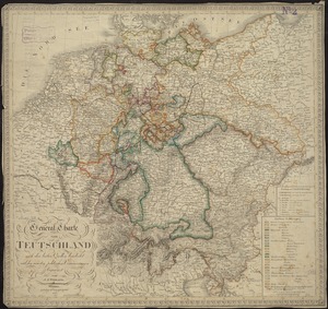
General-Charte von Teutschland nach den besten Quellen bearbeitet und den neuesten politischen Veraenderungen begrenzt
22.
Germany
23.
Germany
24.
Germany, concentration camps (June--1944)
25.
Germany, main movements of freight traffic
26.
Germany, main movements of freight traffic, 1942
27.
Germany, postal administrative districts, March 1943
28.
Germany western border regions rail traffic volume (excluding inter-Ruhr traffic) summer 1939
29.
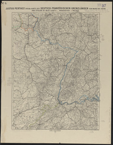
Justus Perthes' special-karte der Deutsch-Französischen Grenzländer von Mainz bis Bern : (aus Stielers 25-blatt-karte)
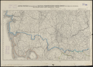
30.
Justus Perthes' specialkarte der Deutsch-Französischen Grenzländer von Mainz bis zur Nordsee : (aus Stielers 25-blatt-karte)
31.
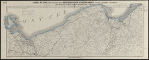
Justus Perthes' specialkarte der norddeutschen küstenländer von der I. Rügen bis Königsberg : (aus Stielers 25-blatt-karte)
32.
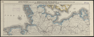
Justus Perthes' specialkarte der norddeutschen küstenländer von Emden & Borkum bis zur insel Rügen : (aus Stielers...
33.
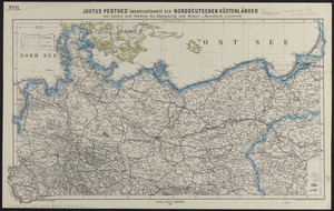
Justus Perthes' übersichtskarte der norddeutschen küstenländer von Emden und Borkum bis Königsberg und Memel
34.
Justus Perthes' übersichtskarte der Westdeutschen grenzlande von Kopenhagen bis Basel und von Chalons bis München
35.
Justus Perthes' übersichtskarte vom nordöstlichen Frankreich bis Paris &c
36.
Karte vom kriegsschauplatze in autographie : herausgegeben zum besten der verwundeten u. hinterbliebenen
37.
Karte von Deutschland : in IV Blättern entworfen im Jahre 1805, und nach den, durch die Bundesacte der Reinschen...
38.
Kriegs-karte 1870
39.
Map of the seat of war
40.
Map of the seat of war in Europe compiled from the latest and most authentic sources
41.
A map of the seat of war in France, with the country divided into its several departments
42.
Military map of the theatre of war between France and Germany
43.
New map of the Rhine and borderlands of France and Prussia, shewing Belgium, Switzerland, Luxemburg, &c.
44.
Philips' large scale contoured map of the Anglo-French front
45.
A pictorial map of Germany
46.
A pictorial map of Germany
47.
Post und reise-karte von Deutschland und den anliegenden ländern : für extraposten, couriere, diligencen und eilwagen
48.
Post- und reise-karte von Deutschland und den anliegenden ländern bis London, Havre de Grace, Tours, Lyon, Genua, Bologna,...
49.
Post-reise-karte von Deutschland mit spezieller angabe der eisenbahn- und dampfschiffahrt-verbindungen : unter der leitung der...
50.
Post-World War I Germany
51.
Rand, McNally & Co.'s indexed atlas of the world map of Germany
52.
Seat of war on the Rhine and Moselle
53.
Specialkarte vom kriegsschauplatz am Rhein 1870 (Erfurt bis Paris) : Belgien, nordöstliches Frankreich, Luxembourg,...
54.
Übersichtskarte der Deutschen Nord u. Ost-see küste
55.
Übersichts-karte der länder zwischen Berlin u. Paris
56.
Völker und sprachen-karte von Deutschland und den nachbarländern im j. 1867
57.
Vom Rhein bis Paris
58.
War map of the Rhine frontiers
59.
Western theatre-European war
60.
The 100th anniversary map of Abraham Lincoln's visit to Massachusetts, September 11-23, 1848
61.
1630 shoreline
62.
1879. Progress map of the U.S. Geographical Surveys west of the 100th Meridian : prepared under the direction of 1st Lieut....
63.
1903 Map of Salem and surrounding places
64.
19th annual convention of the National Association of Real Estate Boards : at Tulsa, June 7 to June 11 in 1926
65.
2005 significant U.S. hurricane strikes
66.
The 2100 project : an atlas for the Green New Deal
67.
227 Harzgerode
68.
305 Glatz
69.
38,000,000 escaped -- 10,000,000 died
70.
4 Kinten
71.
660 Wakulah St., Roxbury
72.
[A chart of Boston Bay and vicinity]
73.
[A chart of New York Island & North River : East River, passage through Hell Gate, Flushing Bay, Hampstead Bay, Oyster,...
74.
The A.A.A. key road map of continental Europe
75.
Aaron Bohrod's America, its history
76.
ABC pathfinder railway guide map : eastern division
77.
Abolition of Slavery, 1863
78.
Aboriginal map of North America, denoting the boundaries and the locations of various Indian tribes
79.
Acapulco, México
80.
Accurata delineatio Castrorum Suecicorum, ut et Haffniae, Regni Daniae Metropolis
81.
Accurata delineatio oppugnatae a faederatis, Caesareis, Polonicis, Danicis, et Brandeburgicis copijs sub-ductu Seren: Electoris...
82.
Accurata delineatio regionis circa Nieburgum Fioniæ cum prælio ibi commisso inter Danorum et fæderatorum exercitum ab una et...
83.
Accurata Scaniae, Blekingiae et Hallandiae descriptio
84.
An accurate map of Cuba, and the adjacent islands
85.
An accurate map of Dorset Shire divided into hundreds
86.
An accurate map of Dorset Shire, divided into its hundreds
87.
An accurate map of England and Wales with the principal roads from the best authorities
88.
An accurate map of England and Wales with the principal roads from the best authorities
89.
An accurate map of Europe from the best authorities
90.
An accurate map of Hindostan or India, from the best authorities
91.
An accurate map of His Majesty's province of New-Hampshire in New England : taken from actual surveys of all the inhabited...
92.
An Accurate map of New Hampshire in New England, from a late survey
93.
An Accurate map of New York in North America, from a late survey
94.
An accurate map of North America : describing and distinguishing the British and Spanish dominions on this great continent :...
95.
An accurate map of North America : describing and distinguishing the British and Spanish dominions of this great continent;...
96.
An accurate map of North America : describing and distinguishing the British, Spanish and French dominions on this great...
97.
An accurate map of North and South Carolina with their Indian frontiers, shewing in a distinct manner all the mountains,...
98.
An accurate map of Rhode Island, part of Connecticut and Massachusets, shewing Admiral Arbuthnot's station in blocking up...
99.
An accurate map of the coast of Cape de Verde
100.
An accurate map of the Commonwealth of Massachusetts exclusive of the district of Maine : compiled pursuant to an Act of the...
‹ Prev
Next ›
1
2
3
4
5
…
81
82


![[A chart of Boston Bay and vicinity]](https://bpldcassets.blob.core.windows.net/derivatives/images/commonwealth:cj82m2976/image_thumbnail_300.jpg)


