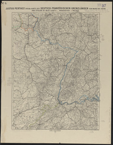
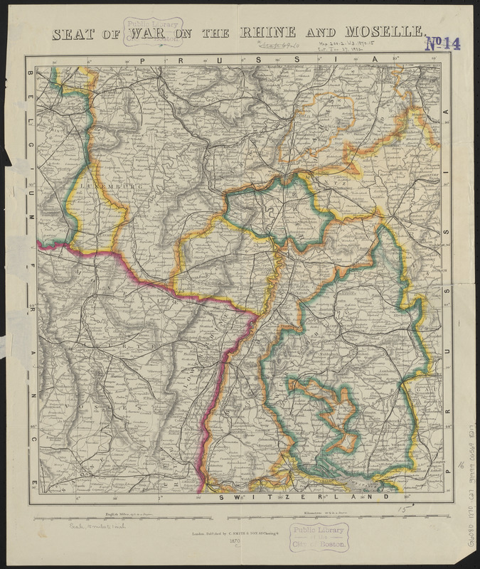
Seat of war on the Rhine and Moselle
Item Information
- Title:
- Seat of war on the Rhine and Moselle
- Title (alt.):
-
Map of the seat of war in France & Germany shewing the Rhine Valley from Basle to Cologne, and the country 100 miles east and west, also the roads, railways & fortifications
- Publisher:
- C. Smith & Son
- Date:
-
1870
- Format:
-
Maps/Atlases
- Location:
-
Boston Public Library
Norman B. Leventhal Map & Education Center - Collection (local):
-
Norman B. Leventhal Map & Education Center Collection
- Subjects:
-
Franco-Prussian War, 1870-1871--Maps
Germany--Maps
- Places:
-
Germany
- Extent:
- 1 map : color ; 41 x 39 cm
- Terms of Use:
-
No known copyright restrictions.
No known restrictions on use.
- Publisher:
-
London :
C. Smith & Son
- Scale:
-
Scale approximately 1:950,000
- Language:
-
English
- Notes:
-
Relief shown by hachures.
- Identifier:
-
06_01_014027
- Call #:
-
G6080 1870 .C27
- Barcode:
-
39999065698217