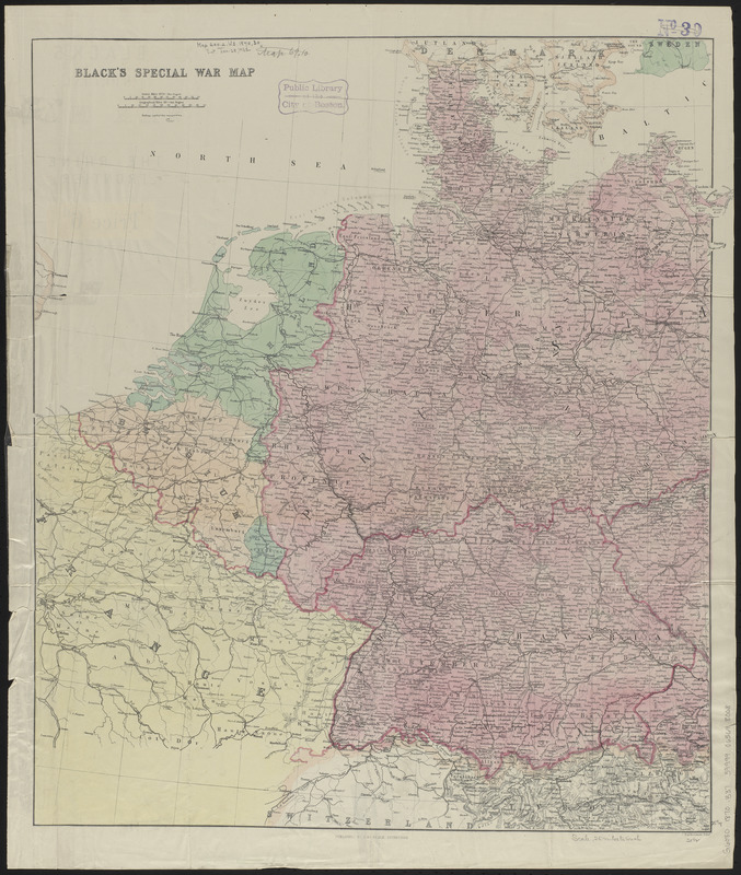
Black's special war map
Item Information
- Title:
- Black's special war map
- Title (alt.):
-
Black's special war map : the Rhine frontier
- Cartographer:
- Bartholomew, John, 1831-1893
- Publisher:
- Adam and Charles Black (Firm)
- Name on Item:
-
J. Bartholomew
- Date:
-
[1870–1871]
- Format:
-
Maps/Atlases
- Location:
-
Boston Public Library
Norman B. Leventhal Map & Education Center - Collection (local):
-
Norman B. Leventhal Map & Education Center Collection
- Subjects:
-
Franco-Prussian War, 1870-1871--Maps
Germany--Maps
France--Maps
- Places:
-
Germany
France
- Extent:
- 1 map : color ; 64 x 55 cm, folded to 24 x 15 cm
- Terms of Use:
-
No known copyright restrictions.
No known restrictions on use.
- Publisher:
-
Edinburgh :
A. & C. Black
- Scale:
-
Scale approximately 1:1,590,000
- Language:
-
English
- Notes:
-
Relief shown by hachures.
Map of Europe exhibiting the principal fortresses & fortified towns on verso.
Edition statement from cover.
- Notes (date):
-
This date is inferred.
- Identifier:
-
06_01_014038
- Call #:
-
G6080 1870 .B373
- Barcode:
-
39999065698068