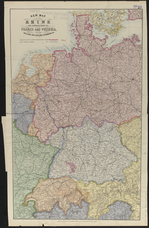
New map of the Rhine and borderlands of France and Prussia, shewing Belgium, Switzerland, Luxemburg, &c.
Item Information
- Title:
- New map of the Rhine and borderlands of France and Prussia, shewing Belgium, Switzerland, Luxemburg, &c.
- Title (alt.):
-
Cruchley's map of the Rhine, and borders of France & Prussia : showing Belgium, Holland, Switzerland, Luxembourg, &c and the fortified towns, railways, roads, &c.
- Date:
-
[1870]
- Format:
-
Maps/Atlases
- Location:
-
Boston Public Library
Norman B. Leventhal Map & Education Center - Collection (local):
-
Norman B. Leventhal Map & Education Center Collection
- Subjects:
-
Germany--Maps
- Places:
-
Germany
- Extent:
- 1 map : color ; 86 x 52 cm, folded in cover 23 x 16 cm
- Terms of Use:
-
No known copyright restrictions.
No known restrictions on use.
- Publisher:
-
London :
G.F. Cruchley
- Scale:
-
Scale approximately 1:1,310,000
- Language:
-
English
- Notes:
-
Relief shown by hachures.
- Notes (date):
-
This date is inferred.
- Identifier:
-
06_01_014000
- Call #:
-
G6080 1870 .N49
- Barcode:
-
39999065698357