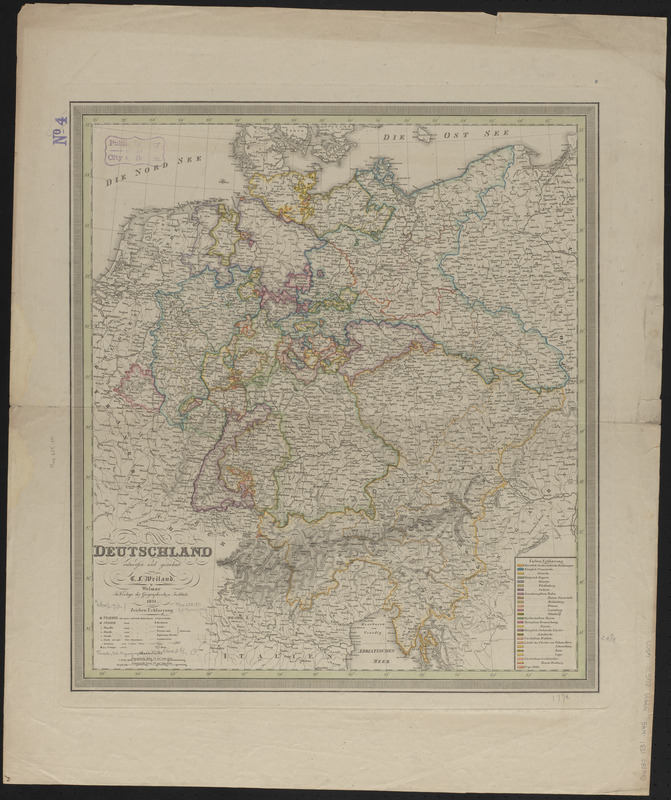
Deutschland
Item Information
- Title:
- Deutschland
- Cartographer:
- Weiland, C. F. (Carl Ferdinand), 1782-1847
- Publisher:
- Geographisches Institut (Weimar, Thuringia, Germany)
- Name on Item:
-
entworfen und gezeichnet von C.F. Weiland
- Date:
-
1831
- Format:
-
Maps/Atlases
- Location:
-
Boston Public Library
Norman B. Leventhal Map & Education Center - Collection (local):
-
Norman B. Leventhal Map & Education Center Collection
- Subjects:
-
Europe, Central--Maps
Germany--Maps
- Places:
-
Germany
Central Europe (area)
- Extent:
- 1 map : color ; 52 x 46 cm
- Terms of Use:
-
No known copyright restrictions.
No known restrictions on use.
- Publisher:
-
Weimar :
Im verlage des Geographischen Instituts
- Scale:
-
Scale approximately 1:2,400,000
- Language:
-
German
- Notes:
-
Relief shown by hachures.
Prime meridian: [Ferro].
- Identifier:
-
06_01_014832
- Call #:
-
G6030 1831 .W45
- Barcode:
-
39999065706507


