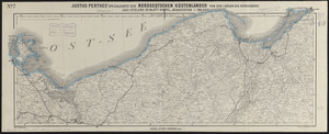
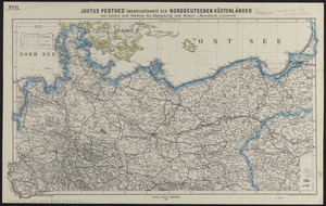
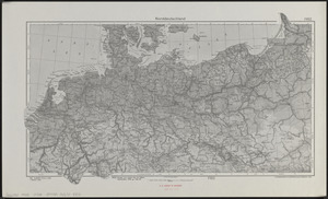
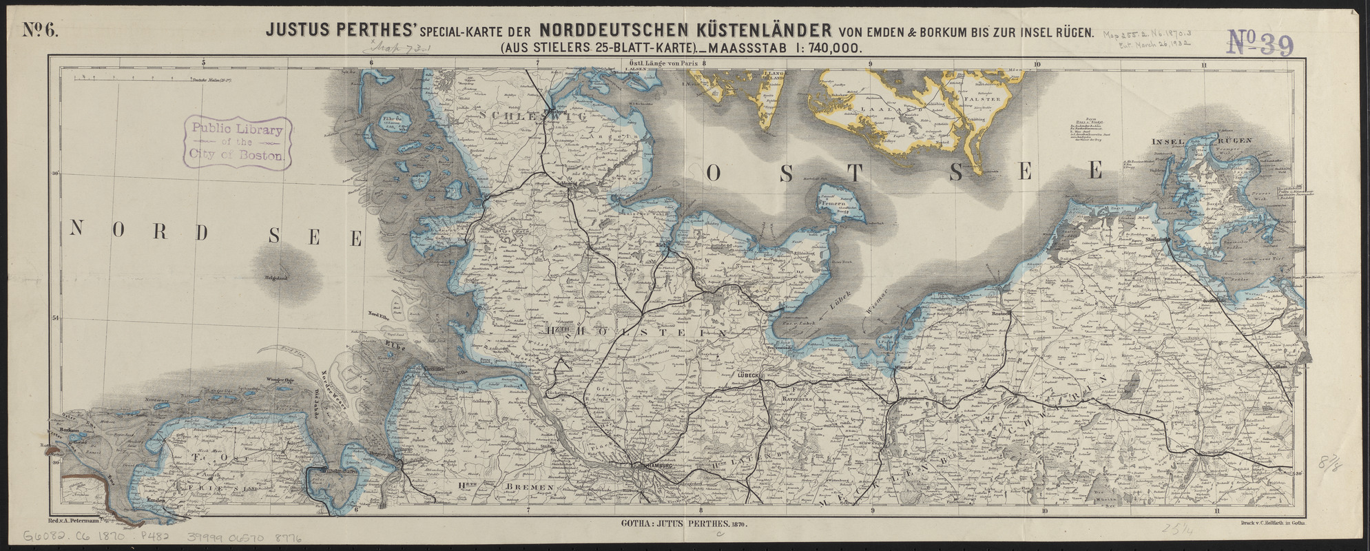
Justus Perthes' specialkarte der norddeutschen küstenländer von Emden & Borkum bis zur insel Rügen : (aus Stielers 25-blatt-karte)
Item Information
- Title:
- Justus Perthes' specialkarte der norddeutschen küstenländer von Emden & Borkum bis zur insel Rügen : (aus Stielers 25-blatt-karte)
- Title (alt.):
-
Specialkarte der norddeutschen küstenländer von Emden & Borkum bis zur insel Rügen
- Cartographer:
- Petermann, A. (August), 1822-1878
- Printer:
- Hellfarth, C.
- Publisher:
- Justus Perthes (Firm : Gotha, Germany)
- Name on Item:
-
red. v. A. Petermann
- Date:
-
1870
- Format:
-
Maps/Atlases
- Location:
-
Boston Public Library
Norman B. Leventhal Map & Education Center - Collection (local):
-
Norman B. Leventhal Map & Education Center Collection
- Subjects:
-
Coasts--Germany--Maps
Germany--Maps
Germany, Northern--Maps
- Places:
-
Germany
GermanyNorthern Germany (area)
- Extent:
- 1 map : color ; 25 x 67 cm
- Terms of Use:
-
No known copyright restrictions.
No known restrictions on use.
- Publisher:
-
Gotha :
Justus Perthes
- Scale:
-
Scale 1:740,000
- Language:
-
German
- Notes:
-
Relief shown by hachures.
Prime meridian: Paris.
In upper left: no. 6.
- Identifier:
-
06_01_014938
- Call #:
-
G6082.C6 1870 .P482
- Barcode:
-
39999065708776