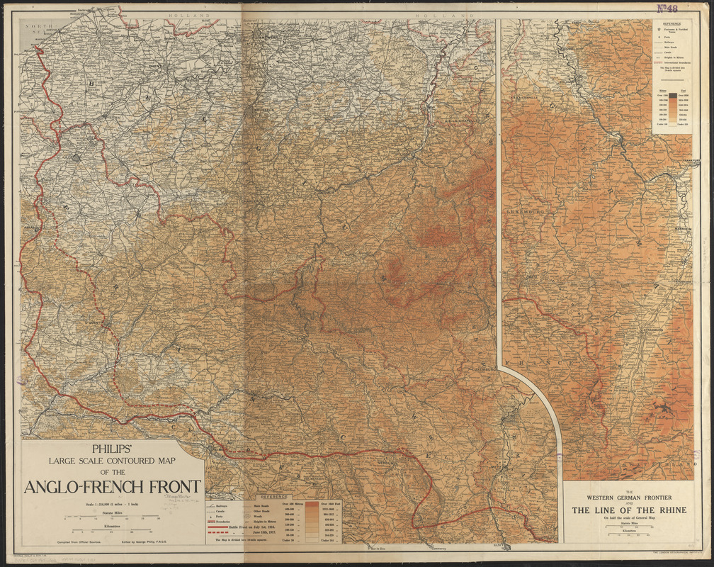
Philips' large scale contoured map of the Anglo-French front
Item Information
- Title:
- Philips' large scale contoured map of the Anglo-French front
- Title (alt.):
-
Western German frontier and the line of the Rhine
- Publisher:
- George Philip & Son
- Name on Item:
-
edited by George Philip
- Date:
-
[1917]
- Format:
-
Maps/Atlases
- Location:
-
Boston Public Library
Norman B. Leventhal Map & Education Center - Collection (local):
-
Norman B. Leventhal Map & Education Center Collection
- Subjects:
-
World War, 1914-1918--Campaigns--Western Front--Maps
France--Maps
Germany--Maps
- Places:
-
France
Germany
- Extent:
- 1 map : color ; 88 x 112 cm
- Terms of Use:
-
No known copyright restrictions.
No known restrictions on use.
- Publisher:
-
[London] :
George Philip & Son, Ltd.
- Scale:
-
Scale 1:316,800
- Language:
-
English
- Notes:
-
Shows battle front on July 1st, 1916 and battle front on June 15th, 1917.
Relief shown by gradient tints and hachures.
Inset: The western German frontier and the line of the Rhine on half the scale of general map.
- Notes (date):
-
This date is inferred.
- Identifier:
-
06_01_014111
- Call #:
-
G5701.S65 1917 .G46
- Barcode:
-
39999065699330