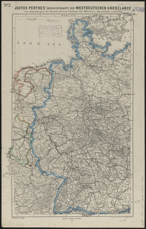
Justus Perthes' übersichtskarte der Westdeutschen grenzlande von Kopenhagen bis Basel und von Chalons bis München
Item Information
- Title:
- Justus Perthes' übersichtskarte der Westdeutschen grenzlande von Kopenhagen bis Basel und von Chalons bis München
- Cartographer:
- Vogel, C. (Carl), 1828-1897
- Printer:
- Hellfarth, C.
- Cartographer:
- Petermann, A. (August), 1822-1878
- Publisher:
- Justus Perthes (Firm : Gotha, Germany)
- Name on Item:
-
bearbeitet von C. Vogel ; A. Petermann red.
- Date:
-
1870
- Format:
-
Maps/Atlases
- Location:
-
Boston Public Library
Norman B. Leventhal Map & Education Center - Collection (local):
-
Norman B. Leventhal Map & Education Center Collection
- Subjects:
-
Germany--Maps
- Places:
-
Germany
- Extent:
- 1 map : color ; 50 x 32 cm
- Terms of Use:
-
No known copyright restrictions.
No known restrictions on use.
- Publisher:
-
Gotha :
Justus Perthes
- Scale:
-
Scale 1:1,850,000
- Language:
-
German
- Notes:
-
Relief shown by hachures.
Prime meridian: Paris.
In upper left: no. 1.
- Identifier:
-
06_01_014158
- Call #:
-
G6080 1870 .V64
- Barcode:
-
39999065700724