Toggle navigation
LMEC Home
Exhibitions
Georeferencing
Tools for Teachers
Collections
My Favorites
Sign Up / Log In
Search
Search the map portal
Map Collection
Map Collection
Map Sets
Search
Search
Search for
Search In
All Fields
Creator
Title
Subject
Place
Search All Digital Collections
Advanced Search
8217 Results
My Search
Start Over
More Like
commonwealth:4m90fd86m
Remove constraint More Like: commonwealth:4m90fd86m
Filter your Search
Place
North and Central America
4,954
United States
3,645
Suffolk (county)
1,026
Boston
999
Europe
963
Canada
450
France
269
Massachusetts
249
more
Place
»
Topic
Boston (Mass.)--Maps
574
United States--Maps
314
Real property--Massachusetts--Boston--Maps
174
Massachusetts--Maps
160
Landowners--Massachusetts--Boston--Maps
132
New England--Maps
104
North America--Maps--Early works to 1800
103
Europe--Maps
78
more
Topic
»
Date
Date range begin
–
Date range end
Current results range from
1482
to
2023
View distribution
Creator
United States. Hydrographic Office
357
O.H. Bailey & Co
148
Des Barres, Joseph F. W. (Joseph Frederick Wallet), 1722-1824
123
United States. Post Office Dept
120
Ptolemy, 2nd cent
100
Walling, Henry Francis, 1825-1888
94
Jefferys, Thomas, -1771
84
Geological Survey (U.S.)
83
more
Creator
»
Format
Maps/Atlases
8,158
Manuscripts
215
Prints
52
Books
36
Objects/Artifacts
10
Drawings/Illustrations
8
Posters
4
Georeferenced
Yes
870
No
7,347
Collection
Norman B. Leventhal Map Center Collection
8,170
Boston and New England Maps
2,184
Urban Maps
1,925
Maritime Charts and Atlases
750
American Revolutionary War-Era Maps
661
Boston Redevelopment Authority Collection
86
American Antiquarian Society Collection
23
William L. Clements Library Collection
20
more
Collection
»
Available to use
No known restrictions
8,027
Creative Commons license
49
Search Constraints
Sort by relevance
relevance
title
date (asc)
date (desc)
Number of results to display per page
100 per page
10
per page
20
per page
50
per page
100
per page
View results as:
grid view
map view
Search Results
1.
Dinsmore's complete map of the railroads & canals in the United States & Canada
2.
Dinsmore's new railroad map of the United States and the Canadas, showing all the railroads completed and in progress,...
3.
General railway map engraved expressly for the Official guide of the railways and steam navigation lines of the United States,...
4.
Complete map of the rail roads and water courses in the United States & Canada
5.
Dinsmore's complete map of the railroads & canals in the United States & Canada
6.
E.P. Dutton & Co.'s railroad, steam boat & stage route map of New England, New-York and Canada
7.
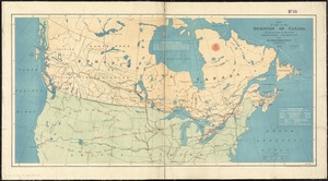
Map of the Dominion of Canada
8.
Map shewing the railways of Canada, to accompany annual report on railway statistics 1884
9.
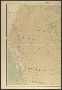
Map showing mounted police stations in north-western Canada
10.
Relief map of the Dominion of Canada
11.
Williams' telegraph and rail road map of the New England states, eastern protion of New York state and Canada : compiled from...
12.
Appletons' railway map of the United States and Canada
13.
Appletons' railway map of the United States and the Canadas : representing railways in actual operation, and those in the...
14.
Colton's general map of the United States : showing the railroad routes across the continent
15.
Colton's new railroad map of the United States & Canada
16.
Diagram of the United States of America, Mexico, the West India Islands and Isthmus of Darien : showing proposed routes of the...
17.
Disturnell's new map of the United States and Canada showing all the canals, rail roads, telegraph lines and principal stage...
18.
Ensign, Bridgman & Fanning's rail road map of the United States, showing the depots & stations
19.
Hammond's comprehensive map of the United States with portions of Canada and Mexico
20.
Lloyd's American railroad map
21.
Lloyd's American railroad map
22.
Lloyd's new county map of the United States and Canadas showing battle fields, railroads, &c., compiled from the latest...
23.
Map of all the railroads in the United States in operation and progress
24.
Map of the Mexican National Railway : showing also its relative position to the railway system of the United States, both as to...
25.
Map of the public land states and territories : constructed from the Public Surveys and other official sources in the General...
26.
Map of the United States of America, the British provinces, Mexico, the West Indies and Central America, with part of New...
27.
Military map of the United States
28.
Military map of the United States of America showing location of all forces in training
29.
New map of the American overland route showing its connections, and land grants of 30,000,000 acres
30.
A new map of the United States of America
31.
Rail road map of the southern states shewing the southern & southwestern railway connections with Philadelphia
32.
Railroad distance map of the United States, Mexico & Canada
33.
Rand McNally & Co's new railroad and county map of the United States and Dominion of Canada
34.
Rock Island-Frisco lines and Chicago & Eastern Illinois R.R : traverse the richest and most prosperous commonwealths in the Union
35.
Skeleton map of rail-roads between Cape Canso and St. Louis
36.
Skeleton map showing the rail roads completed and in progress in the United States and their connection as proposed with the...
37.
The southwestern railroad system United States and Mexico
38.
Traveler's rail road map of the United States to accompany "Boston to Washington" Riverside Series Centennial Guides
39.
Venango railroad and its connections, air line from New York to Cleveland, Toledo & Chicago
40.
Aboriginal map of North America, denoting the boundaries and the locations of various Indian tribes
41.
The Dominion of Canada from the latest surveys and data
42.
A Map exhibiting the frontiers of Canada and the United States : intended to illustrate the operations of the British &...
43.
Map of North America : showing all routes to Alaska and Klondike country
44.
Relief map of Canada and the United States
45.
Schonberg's imperial map of the United States and Canada : constructed, drawn and compiled from the latest and best authorities...
46.
America Septentrionalis : a Domino d'Anville in Galliis edita nune in Anglia Coloniss in Interiorem Virginiam deductis nec non...
47.
The British governments in Nth. America : laid down agreeable to the proclamation of Octr. 7, 1763
48.
Carte des pays connus sous le nom de Canada, : dans laquelle sont distinguées les possessions françoises, et angl?
49.
A General map of North America; : from the latest observations
50.
Karte von den seen in Canada
51.
A Map of the British dominions in North America as settled by the late treaty of Peace 1763
52.
A map of the British empire, in North America
53.
A Map of the present seat of war in North America
54.
A New & accurate map of North America, : including the British acquisitions gain'd by the late war, 1763
55.
A new map of the British empire in Nth. America
56.
Partie occidentale du Canada, : contenant les cinq Grands Lacs, avec les pays circonvoisins
57.
The United States of North America with the British & Spanish territories according to the treaty
58.
Map of part of the Dominion of Canada, shewing location of some of the principal products, also railway & water routes
59.
Sherman & Smith's rail road, steam boat & stage route map of New England, New-York, and Canada
60.
Colton's new railroad & county map of the United States, the Canadas &c
61.
How the public domain has been squandered, map showing the 139,403,026 acres of the people's land - equal to 871,268 farms of...
62.
Map of the seat of war : containing a map of the vicinity of Washington, Baltimore, Harper's Ferry and Annapolis, with five...
63.
Texas and Pacific Rail Way
64.
Western route, from Boston to Michigan, Ohio and Indiana ; Southern route, from Boston to Wilmington and Red Clay ; S. Western...
65.
British America, comprehending Canada, Labrador, New-Foundland, Nova Scotia &c
66.
British possessions in North America
67.
The British possessions in North America from the best authorities
68.
The British possessions in North America from the best authorities
69.
Canada and Nova Scotia
70.
Canada and Nova Scotia
71.
Carte de la Nouvelle-France, augmentée depuis la derniere, servant a la navigation faicte en son vray Meridien par le Sr. de...
72.
Coal areas of Canada
73.
Dawson's map of the Dominion of Canada
74.
Dominion of Canada
75.
Government map of part of the Huron and Ottawa Territory, Ontario
76.
A map of Canada
77.
A map of the province of Upper Canada, describing all the new settlements, townships, & cc. with the countries adjacent, from...
78.
Map of the provinces of upper & lower Canada with the adjacent parts of the United States of America, &c
79.
Map to accompany the report on the exploratory survey of the Canadian Pacific Railway
80.
Minerals
81.
New map of the Dominion of Canada
82.
19th annual convention of the National Association of Real Estate Boards : at Tulsa, June 7 to June 11 in 1926
83.
2005 significant U.S. hurricane strikes
84.
The 2100 project : an atlas for the Green New Deal
85.
38,000,000 escaped -- 10,000,000 died
86.
Abolition of Slavery, 1863
87.
The adventures of Mark Twain
88.
Alden's pictorial map of the United States of North America
89.
Alien and Sedition Acts, February 25, 1799, Votes on resolutions for repeal
90.
America : beauty, wonders, inspiration, progress, without end
91.
America the wonderland : a pictorial map of the United States
92.
American explorations in the West, 1803-1852
93.
Amérique Septentrionale
94.
Armour food source map
95.
Base-map of the United States
96.
Being a map of the United States in the year 1831 when the Country Gentleman first made its appearance as the Genesee Farmer
97.
Broadway of America an all year ... all weather comfortable route from coast to coast
98.
Carte des Etats-Unis
99.
Carte des Etats-Unis de l'Amérique-Nord : pour servir aux observations géologiqueir
100.
Carte générale des États-Unis de l'Amérique avec les plans des principales villes
‹ Prev
Next ›
1
2
3
4
5
…
82
83