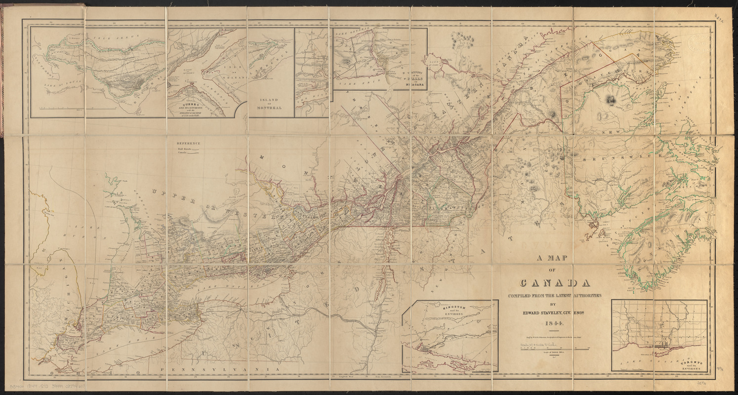
A map of Canada
Item Information
- Title:
- A map of Canada
- Cartographer:
- Staveley, Edward, 1795-1872
- Engraver:
- W. & A.K. Johnston Limited
- Publisher:
- Armour & Ramsay
- Name on Item:
-
compiled from the latest authorities by Edward Staveley, Civ. Engr. 1844 ; engd. by W. & A.K. Johnston, geographers & engravers to the Queen, Edinr.
- Date:
-
1844
- Format:
-
Maps/Atlases
- Location:
-
Boston Public Library
Norman B. Leventhal Map & Education Center - Collection (local):
-
Norman B. Leventhal Map & Education Center Collection
- Subjects:
-
Canada--Maps
- Places:
-
Canada
- Extent:
- 1 map : color, sectioned and mounted on cloth ; 47 x 94 cm, folded in cover 19 x 12 cm
- Terms of Use:
-
No known copyright restrictions.
No known restrictions on use.
- Publisher:
-
Montreal :
Armour & Ramsay
- Scale:
-
Scale approximately 1:1,800,000
- Language:
-
English
- Notes:
-
Relief shown by hachures.
Includes 5 insets: Island of Montreal -- Quebec and its environs with the operation of the siege of 1759 under Wolfe -- Vicinity of the Falls of Niagara -- Kingston and its environs -- Toronto and its environs.
Shows international, district, county and township boundaries, railroads and canals.
Publisher label pasted inside of front cover.
- Identifier:
-
06_01_016337
- Call #:
-
G3400 1844 .S73
- Barcode:
-
39999085946117


