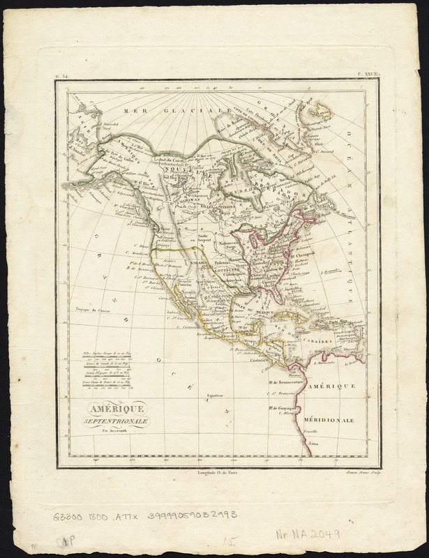
Amérique Septentrionale
This map is also available in American Revolutionary Geographies Online (ARGO), a collections portal especially built for material relating to the American Revolutionary War Era. Visit ARGO to learn more about this item and explore the historical geography of North America in the late eighteenth century.
Item Information
- Title:
- Amérique Septentrionale
- Creator:
- Arrowsmith, Aaron, 1750-1823
- Name on Item:
-
par Arrowsmith ; Semen Jeune sculp.
- Date:
-
[1800?]
- Format:
-
Maps/Atlases
- Location:
-
Boston Public Library
Norman B. Leventhal Map & Education Center - Collection (local):
-
Norman B. Leventhal Map & Education Center Collection
- Subjects:
-
United States--Maps
- Places:
-
United States
- Extent:
- 1 map : col. ; 23 x 19 cm.
- Terms of Use:
-
No known copyright restrictions.
No known restrictions on use.
- Publisher:
-
S.l :
s.n.
- Scale:
-
Scale ca. 1:60,000,000.
- Language:
-
French
- Notes:
-
Relief shown by hachures.
In upper margin: "G.34" and "P. XXVIII."
Map of North America, in cluding Canada, Central America and the West Indies. Many Indian tribes and villages are named. Florida is divided into the Spanish possessions of East and West Florida, Georgia extends to the Mississippi.
- Identifier:
-
06_01_007533
- Call #:
-
G3300 1800 .A77x
- Barcode:
-
39999059032993


