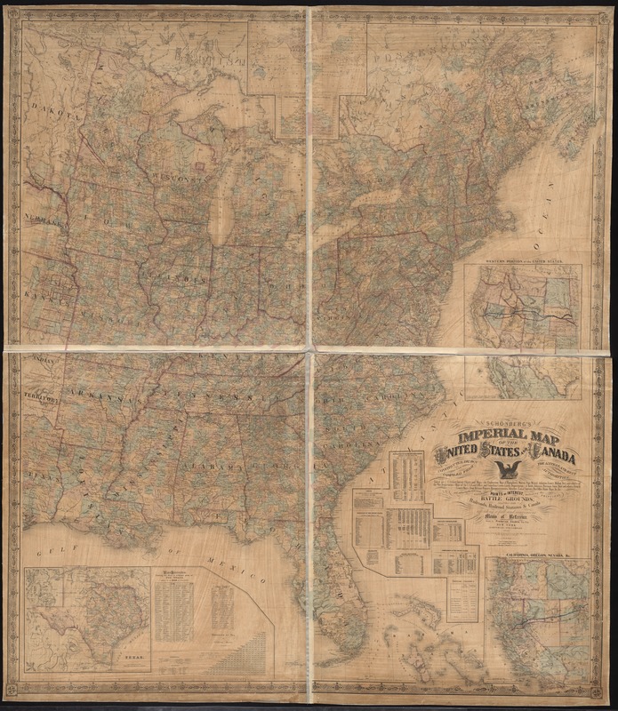
Schonberg's imperial map of the United States and Canada : constructed, drawn and compiled from the latest and best authorities such as U.S. Coast Survey charts and maps ... and embracing the most recent geographical points of interest ... according a full and convenient means of reference
Item Information
- Title:
- Schonberg's imperial map of the United States and Canada : constructed, drawn and compiled from the latest and best authorities such as U.S. Coast Survey charts and maps ... and embracing the most recent geographical points of interest ... according a full and convenient means of reference
- Title (alt.):
-
Imperial map of the United States and Canada
- Creator:
- Couëtte, Frederick.
- Name on Item:
-
drawn by Frederick Couëtte.
- Date:
-
1865
- Format:
-
Maps/Atlases
- Location:
-
Boston Public Library
Norman B. Leventhal Map & Education Center - Collection (local):
-
Norman B. Leventhal Map & Education Center Collection
- Subjects:
-
United States--Maps
Canada--Maps
- Places:
-
United States
Canada
- Extent:
- 1 map : hand col. ; 159 x 140 cm.
- Terms of Use:
-
No known copyright restrictions.
No known restrictions on use.
- Publisher:
-
New York :
Schönberg and Company
- Scale:
-
Scale 1:1,900,800
- Language:
-
English
- Notes:
-
Shows states and territories, counties, cities, indian lands, railroads, and post routes in the United States and southeastern Canada.
Relief shown by hachures.
Prime meridians: Washington, D.C. and Greenwich.
Insets: [World map] -- Texas -- Western portion of the United States -- California, Oregon, Nevada, &c.
Includes tables and diagram of principal mountains of the world.
- Identifier:
-
06_01_008450
- Call #:
-
G3700 1865 .C68x
- Barcode:
-
39999065676650


