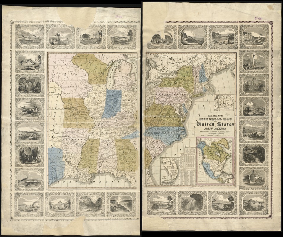
Alden's pictorial map of the United States of North America
Item Information
- Title:
- Alden's pictorial map of the United States of North America
- Creator:
- Alden, Albert.
- Date:
-
[1845]
- Format:
-
Maps/Atlases
- Location:
-
Boston Public Library
Norman B. Leventhal Map & Education Center - Collection (local):
-
Norman B. Leventhal Map & Education Center Collection
- Subjects:
-
United States--Maps
- Places:
-
United States
- Extent:
- 1 map on 2 sheets : hand col. ; 70 x 94 cm., on sheets 120 x 74 cm.
- Terms of Use:
-
No known copyright restrictions.
No known restrictions on use.
- Publisher:
-
Barre, Mass :
Albert Alden
- Scale:
-
Scale [ca. 1:29,000,000]
- Language:
-
English
- Notes:
-
Relief shown by hachures.
Prime meridian: Washington D.C.
Insets: [Southern part of Florida] -- Northern boundary of Maine -- Map of North America.
Includes tables.
Views in margins.
- Notes (date):
-
This date is inferred.
- Identifier:
-
06_01_008444
- Call #:
-
G3700 1845 .A43x
- Barcode:
-
39999065654814


