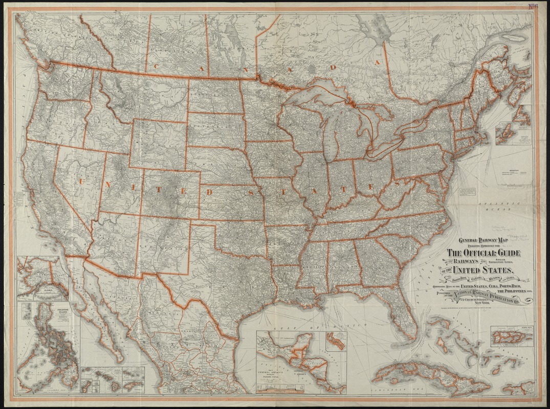
General railway map engraved expressly for the Official guide of the railways and steam navigation lines of the United States, Porto Rico, Canada, Mexico and Cuba, comprising maps of the United States, Cuba, Porto Rico, the Philippines, etc
Item Information
- Title:
- General railway map engraved expressly for the Official guide of the railways and steam navigation lines of the United States, Porto Rico, Canada, Mexico and Cuba, comprising maps of the United States, Cuba, Porto Rico, the Philippines, etc
- Title (alt.):
-
General railroad map engraved expressly for the Official guide of the railways and steam navigation lines of the United States, Porto Rico, Canada, Mexico and Cuba
- Creator:
- National Railway Publication Company
- Date:
-
1918
- Format:
-
Maps/Atlases
- Location:
-
Boston Public Library
Norman B. Leventhal Map & Education Center - Collection (local):
-
Norman B. Leventhal Map & Education Center Collection
- Subjects:
-
Railroads--United States--Maps
Railroads--Canada--Maps
Railroads--Mexico--Maps
United States--Maps
Canada--Maps
Mexico--Maps
- Places:
-
United States
Mexico
Canada
- Extent:
- 1 map : col. ; 97 x 132 cm., folded to 26 x 17 cm.
- Terms of Use:
-
No known copyright restrictions.
No known restrictions on use.
- Publisher:
-
New York :
National Railway Publication Co.
- Scale:
-
Scale [ca. 1:3,900,000]
- Language:
-
English
- Notes:
-
Relief shown by hachures.
Insets: Alaska -- Philippine Islands -- Guam -- Wake I. -- Howland I. and Baker I. -- Hawaii -- Samoa -- Tutuila I. -- Map of Central America showing the Panama Canal -- Porto Rico -- Continuation of Nova Scotia and Cape Breton Island.
- Identifier:
-
06_01_008453
- Call #:
-
G3701.P3 1918 .N38x
- Barcode:
-
39999065653824


