Rail road map of the southern states shewing the southern & southwestern railway connections with Philadelphia
Item Information
- Title:
- Rail road map of the southern states shewing the southern & southwestern railway connections with Philadelphia
- Description:
-
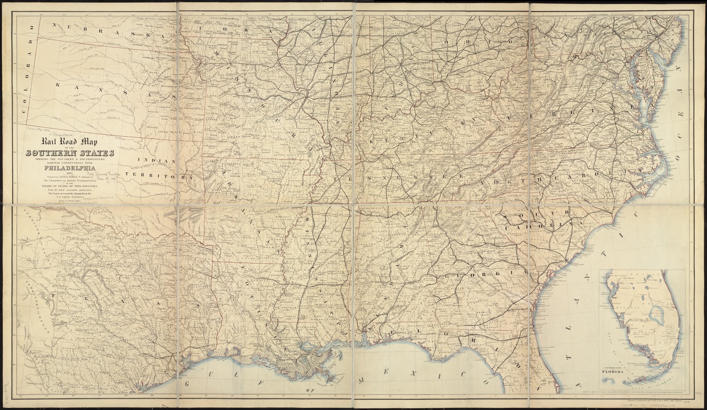
While this appears to be a fairly typical mid-19th century railroad map, it was specifically commissioned by the War Department to provide current information about southern railroads. The map’s significance for military intelligence was recorded in a note written by the cartographer’s widow when she gave this copy to the Boston Public Library. She recalled that the map was displayed in Secretary Stanton’s War Office, where black and red pins were used to locate the varying positions of the two armies, and that the map proved very useful to General Sherman in his march through Georgia to the sea. Mrs. Kimber concluded by stating her husband was a Quaker "and to ease his conscience for having prepared such a map at all he declined any payment for it."
- Creator:
- Kimber, Thomas, 1787-1864
- Name on Item:
-
prepared by Thomas Kimber, Jr. ... from the latest accessible authorities ; the coast accurately drawn from the U.S. Coast Surveys ; drawn & engraved by P.S. Duval & Son.
- Date:
-
1862
- Format:
-
Maps/Atlases
- Location:
-
Boston Public Library
Norman B. Leventhal Map & Education Center - Collection (local):
-
Norman B. Leventhal Map & Education Center Collection
- Subjects:
-
Railroads--United States--Maps
United States--Maps
- Places:
-
United States
- Extent:
- 1 map : col. ; 75 x 133 cm.
- Terms of Use:
-
No known copyright restrictions.
No known restrictions on use.
- Publisher:
-
Philadelphia :
[Thomas Kimber]
- Scale:
-
Scale ca. 1:1,880,000.
- Language:
-
English
- Notes:
-
Entered according to Act of Congress in the year 1862, by Thomas Kimber Jr.
Inset: Southern part of Florida. 25 x 18 cm.
Map depicts rail lines, roads, cities and towns, state and county boundaries, and rivers.
Description derived from published bibliography.
- Notes (exhibitions):
-
Exhibited: "Torn in Two: The 150th Anniversary of the Civil War" organized by the Norman B. Leventhal Map Center at the Boston Public Library, 2011.
- Identifier:
-
06_01_006561
- Call #:
-
G3701.P3 1862 .P45
- Barcode:
-
39999065673012
- LCCN:
-
99447091


