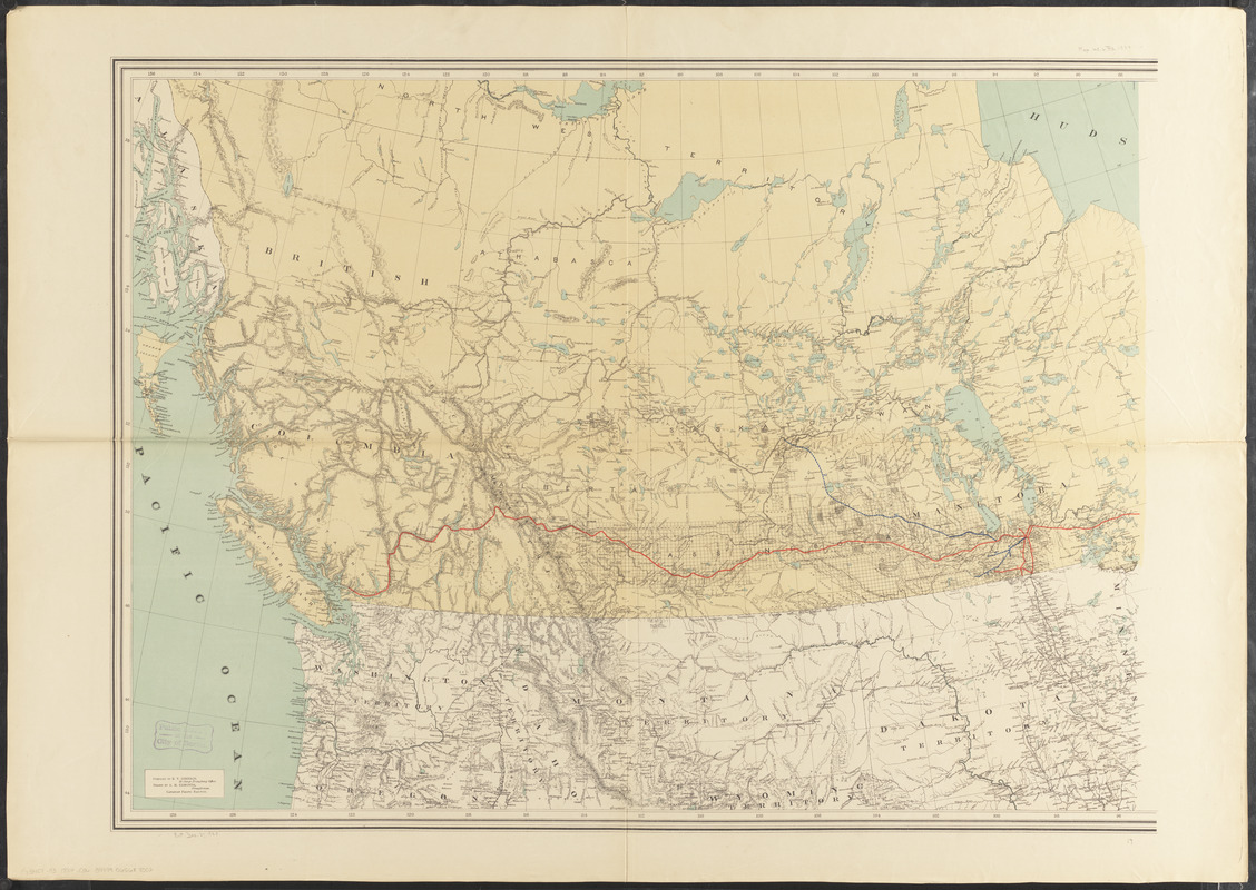
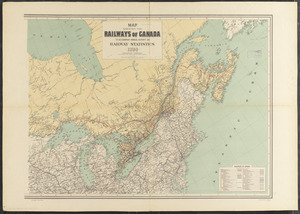
Map shewing the railways of Canada, to accompany annual report on railway statistics 1884

Item Information
- Title:
- Map shewing the railways of Canada, to accompany annual report on railway statistics 1884
- Creator:
- Canadian Government Railways
- Contributor:
- Schreiber, Collingwood, Sir, 1831-1918
- Compiler:
- Johnson, E. V.
- Cartographer:
- Edmonds, A. M.
- Contributor:
- Canadian Pacific Railway Company
- Lithographer:
- Burland Lithographic Co.
- Name on Item:
-
Collingwood Schreiber, Canadian Government Railways ; compiled by E.V. Johnson, drawn by A.M. Edmonds, Canadian Pacific Railway
- Date:
-
1884
- Format:
-
Maps/Atlases
- Location:
-
Boston Public Library
Norman B. Leventhal Map & Education Center - Collection (local):
-
Norman B. Leventhal Map & Education Center Collection
- Subjects:
-
Railroads--Canada--Maps
Canada--Maps
- Places:
-
Canada
- Extent:
- 1 map on 2 sheets : col. ; 70 x 194 cm., on sheets 85 x 119 cm.
- Terms of Use:
-
No known copyright restrictions.
No known restrictions on use.
- Publisher:
-
Ottawa :
[Canadian Government Railways]
- Edition:
- 2nd ed.
- Scale:
-
Scale [ca. 1:2,850,000]
- Language:
-
English
- Notes:
-
Relief shown by hachures.
Includes table of railways of Canada.
- Identifier:
-
06_01_011586B
06_01_011586A
- Call #:
-
G3401.P3 1884 .C36
- Barcode:
-
39999065688002


