Map of the provinces of upper & lower Canada with the adjacent parts of the United States of America, &c
Item Information
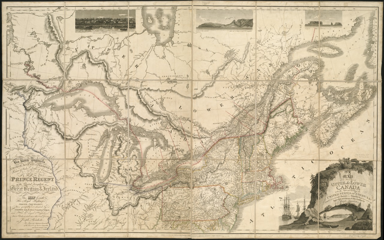
- Title:
- Map of the provinces of upper & lower Canada with the adjacent parts of the United States of America, &c
- Creator:
- Bouchette, Joseph, 1774-1841
- Name on Item:
-
compiled from the latest surveys and adjusted from the most recent and approved astronomical observations by Joseph Bouchette ; engraved by J. Walker.
- Date:
-
1815
- Format:
-
Maps/Atlases
- Location:
-
Boston Public Library
Norman B. Leventhal Map & Education Center - Collection (local):
-
Norman B. Leventhal Map & Education Center Collection
- Subjects:
-
Canada--Maps
North America--Maps
- Places:
-
North America (area)
Canada
- Extent:
- 1 map : hand col. ; 76 x 126 cm.
- Terms of Use:
-
No known copyright restrictions.
No known restrictions on use.
- Publisher:
-
London :
W. Faden
- Scale:
-
Scale [ca. 2,280,960]
- Language:
-
English
- Notes:
-
Published, as the act directs, Augst. 12th, 1815, by W. Faden, geographer to His Majesty & to His Royal Highness the Prince Regent, Charing Cross, London.
Relief shown by hachures.
"To His Royal Highness George Augustus Frederick, Prince of Wales, Duke of Cornwall, &c. &c. &c. and Prince Regent of the United Kingdom of Great Britain & Ireland, this map is ... most gratefully dedicated, by a faithful and zealous Canadian subject ... Joseph Bouchette, His Majesty's surveyor general of the province of Lower Canada, and Lieutt. Colonel C.M."
Includes three inset engravings of views and engraved title vignette.
Cataloging, conservation, and digitization made possible in part by The National Endowment for the Humanities: Exploring the human endeavor.
- Identifier:
-
06_01_006179
- Call #:
-
G3300 1815 .B68
- Barcode:
-
39999059021079


