Toggle navigation
LMEC Home
Exhibitions
Georeferencing
Tools for Teachers
Collections
My Favorites
Sign Up / Log In
Search
Search the map portal
Map Collection
Map Collection
Map Sets
Search
Search
Search for
Search In
All Fields
Creator
Title
Subject
Place
Search All Digital Collections
Advanced Search
168 Results
My Search
Start Over
Date
1750
to
1754
Remove constraint Date: <span class='from'>1750</span> to <span class='to'>1754</span>
Filter your Search
Place
North and Central America
106
United States
40
Canada
29
Europe
19
North America
16
New York
10
Africa
9
South America
9
more
Place
»
Topic
Canada--Maps--Early works to 1800
9
North America--Maps--Early works to 1800
8
New France--Maps
7
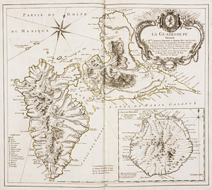
America--Discovery and Exploration--Maps--Early works to 1800
5
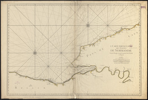
Manuscript maps--Early works to 1800
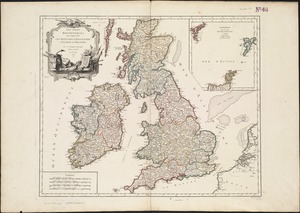
5
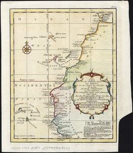
America--Maps--Early works to 1800
4
Indians of North America--Pictorial works
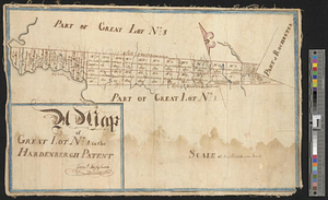
4
Saint Lawrence River--Maps
4
more
Topic
»
Date
1750
to
1754
[remove]
168
Date range begin
–
Date range end
Current results range from
1699
to
1800
1750
to
1750
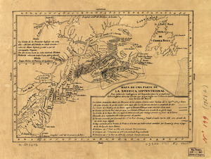
81
1751
to
1751
56
1752
to
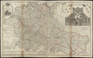
1752
77
1753
to
1753
73
1754
to
1754
72
Creator
Bellin, Jacques Nicolas, 1703-1772
17
Royal United Services Institute for Defence and Security Studies
12
Amherst, Jeffery Amherst, Baron, 1717-1797
9
Moll, Herman, d. 1732
9
Jefferys, Thomas, -1771
8
Buache, Philippe, 1700-1773
7
Robert de Vaugondy, Gilles, 1688-1766
7
George, III, King of Great Britain, 1738-1820
6
more
Creator
»
Format
Maps/Atlases
166
Manuscripts
31
Prints
2
Georeferenced
Yes
6
No
162
Collection
American Revolutionary War-Era Maps
124
Norman B. Leventhal Map & Education Center Collection
54
William L. Clements Library Collection
35
British Library Collection
21
Library of Congress Collection
21
Library and Archives Canada Collection
8
Richard H. Brown Revolutionary War Map Collection at Mount Vernon
8
American Antiquarian Society Collection
6
more
Collection
»
Available to use
Creative Commons license
57
No known restrictions
56
Search Constraints
Sort by relevance
relevance
title
date (asc)
date (desc)
Number of results to display per page
100 per page
10
per page
20
per page
50
per page
100
per page
View results as:
grid view
map view
Search Results
1.
[A manuscript map of Isle Royalle]
2.
An accurate map of the English colonies in North America, bordering on the river Ohio
3.
An accurate map of the West Indies
4.
L'Afrique : dressée sur les relations e nouvelles decouvertes de differens voyageurs, conformes aux observations astronomiques
5.
Algemeene Kaart van de Colonie of Provintie van Suriname, met de rivieren, districten, ontdekkingen door Militaire Togten, en...
6.
Algemeene Kaart van de Colonie of Provintie van Suriname, met de rivieren, districten, ontdekkingen door Militaire Togten, en...
7.
Amerique Septentrionale : Acadie ou Nouvelle Ecosse aux anglois : Annapolis Royal
8.
[Amerique septentrionale]
9.
Amérique Septentrionale : dressée sur les relations les plus modernes des voyageurs et navigateurs, et divisée suivant les...
10.
Begin with sense, of ev'ry art the soul, parts answ'ring parts shall slide into a whole
11.
Britannicae Insulae in quibus Albion seu Britannia Major, et Ivernia seu Britannia Minor : juxta Ptolemaei mentem divisae, tùm...
12.
British dominions in America, drawn from the latest and best authorities
13.
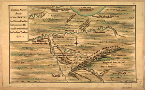
Captain Snow's scetch of the country by himself, and the best accounts he could receive from the Indian traders
14.
Captain Snow's sketch
15.
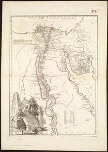
Carte de l'Egypte ancienne et moderne : dressée sur celle du R. P. Sicard, et autres assujetties aux observations astronomique
16.
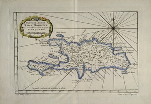
Carte de l'Isle de Saint Domingue : pour servir a l'Histoire générale des voyages
17.
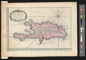
Carte de l'isle de Saint Domingue
18.
Carte de l'isthme de Panama et des provinces de Veragua Terre Ferme er Darien : pour l'histoire générale des voyages
19.
Carte des découvertes qui ont été faites dans la partie occidentale du Canada sur les mémoires de Mr de la Varanderie [Vérendrye]
20.
Carte des nouvelles découvertes au nord de la Mer du Sud, tant à l'est de la Siberie et du Kamtchatka, qu'à l'ouest de la...
21.
Carte des pays connus sous le nom de Canada, : dans laquelle sont distinguées les possessions françoises, et angl?
22.
Carte des provinces de Tabasco, Chiapa, Verapaz, Guatimala, Honduras et Yucatan situées dans l'Amérique Meridionale : pour...
23.
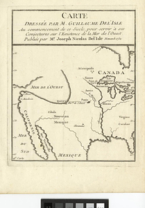
Carte dressée par M. Guillaume De L'Isle au commencement de ce siecle, pour servir à ses conjectures sur l'existence de la Mer...
24.
Carte dressée sur la lettre de l'Admiral de Fonte par l'ecrivain de la Californie
25.
Carte du diocèse d'Uzès
26.
Carte du Golphe du Méxique et des isles de l'Amérique : pour servir à l'Histoire générale des voyages
27.
Carte du havre de Chibucto avec le plan de la ville de Halifax sur la coste de l'Accadia ou Nova Scotia latitude 44° 31ʹ
28.
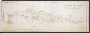
Carte du Lac Champlain depuis le Fort de Chambly Jusques au desus du Fort S.t Frederic, dans la Nouvelle France
29.
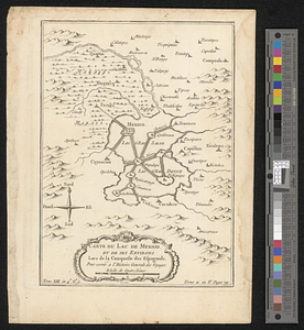
Carte du Lac de Mexico et de ses environs lors de la conqueste des Espagnols : pour servir a l'histoire générale des voyages
30.
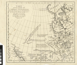
Carte d'une partie de l'Amérique Septentrionale
31.
Carte d'une partie de l'Amérique Septentrionale tirée des manuscripts de M. Guill. De l'Isle ou l'on voit son systeme en 1695...
32.
Carte generale du Canada ou Nouvelle France
33.
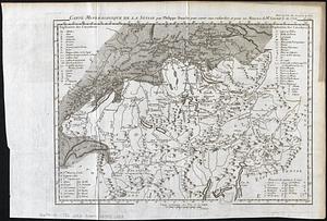
Carte mineralogique de la Suisse
34.
Carte minéralogique, où l'on voit la nature des terreins du Canada et de la Louisiane
35.
Chart comprizing Greenland with the countries and islands about Baffin's and Hudson's Bays
36.
Chart containing the coasts of California, New Albion, and Russian discoveries to the north : with the peninsula of Kamchatka,...
37.
Chart containing the greater part of the South Sea to the south of the line, with islands dispersed thro' the same
38.
A chart of North and South America, including the Atlantic and Pacific Oceans, with the nearest coasts of Europe, Africa and Asia
39.
Chart of South America, comprehending the West Indies, with the adjacent islands, in the Southern Ocean, and South Sea
40.
Chart of the Atlantic Ocean, with the British, French, & Spanish settlements in North America, and the West Indies : as also on...
41.
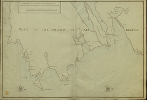
A CHART of the South East Part of l'Isle Royal, or Cape Bretton taken from the best Surveys, and the Observations of the most...
42.
Les Colonies des Européens en Amerique
43.
Constantinople, or Stambol
44.
Copie de la carte de Monsieur Klam ou l'on voit les sources e la riviere d'Orange suivant de nouvelles observation
45.
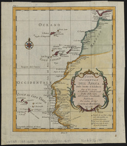
Costa occidentale dell' Africa dallo Stretto di Gibilterra fino al XI grado di latitudine settentrionale tratta dalla carta...
46.
Cours du fleuve St. Laurent : deuxieme feuille : depuis Quebec jusqu'au havre des Papinachouas
47.
Cours du fleuve St. Laurent : premiere feuille : contenant depuis le Lac Ontario jusqu'a Quebec
48.
Cours du fleuve St. Laurent : troisieme feuille : depuis le mont Camille jusqu'a l'isle d'Anticosti
49.
Crown Point to Fort Edward, New York
50.
Cuba, ciudad capittal de la ysla del mismo nombre y su famoso puerto sittuado en la costa del sur de gra. ysla, los 20 grados y...
51.
Le Diocese de Limoges : divisé en ses dix huict Archipretré et les Gouvernemens de la Marche et du Limosin dans les quels il...
52.
Draft of the lands disputed by Philipse Patent against Beekmans & Rambaults
53.
L'Ecosse divisée en shires ou comtés
54.
[Entrance to the Harbour of S.t Johns Newfoundland]
55.
An exact-plan of George-Town : so named by Patrick Graham, Esqr., President of the Province of Georgia, in honr. to His Royal...
56.
A general plan of Annapolis Royal
57.
A general plan of Annapolis Royal
58.
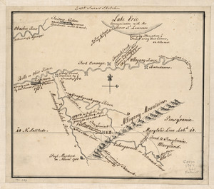
Geographick scetch [sic], 1754
59.
Golphe de Saint Laurent, contenant l'Isle de Terreneuve, Detroit de Belle-Isle, entrée du Fleuve St. Laurent, Isle Royale, et...
60.
La Guadeloupe : dediée à Mgr. Charles Phillippe d'Albert, duc de Luynes ...
61.
The Gulf coast from the Mississippi Delta to the Bay of St. Joseph
62.
I. Carte particulière des costes de Normandie depuis Dieppe jusqu'à la Pointe Percée en Bessin
63.
Les Isles Britanniques : qui comprennent les Royaumes d'Angleterre, d'Ecosse et d'Irlande
64.
Karte von der westlichen kuste von Africa : von der strasse bey Gibraltar bis zu dem XI grade norderbreite ...wahrnehmungen...
65.
Lake Champlain
66.
[Land division survey of Duxbury and Pembroke, MA]
67.
A map of great lot no. 2 in the Hardenbergh Patent
68.
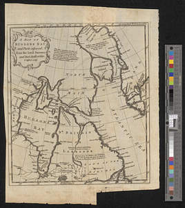
A map of Hudsons Bay and parts adjacent from the latest surveys and best authorities
69.
A map of lot no 1 in the Hardenbergh Patent
70.
A map of lot no 4 in the [Ha]rdenbergh Patent
71.
A map of part of the Isthmus of Darien : shewing the communication with Panama, from Portobello & Chagre both by land, and by...
72.
A map of Pensilvania, New-Jersey, New-York, and the three Delaware counties
73.
A map of Philadelphia and parts adjacent
74.
A map of Savannah River beginning at Stone-Bluff, or Nexttobethell, which continueth to the sea : also, the four sounds...
75.
A Map of the British American plantations, extending from Boston in New England to Georgia : including all the back settlements...
76.
A map of the British and French settlements in North America
77.
A Map of the Country Adjacent to the North Boundary Line of of the Colony of Rhode Island as the same was Run by Commissioners...
78.
A Map of the route from the city of Albany to the Fort Osswego on the Lake of Cataroque
79.
A Map of the western parts of the colony of Virginia
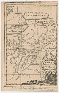
80.
Map of the western parts of the colony of Virginia
81.
A map of the western parts of the colony of Virginia
82.
Map of the western parts of the colony of Virginia, as far as the Mississipi
83.
MAP of the Western parts of the COLONY of VIRGINIA, as far as the Mississipi
84.
A Map of the western parts of the province of Pennsylvania, Virginia, &c
85.
A map or draft of a certain tract and parcell of arable and low land of Collo. Henry Beekman being situate & lying within the...
86.
[Map showing neck of land between 'Baye francaise' and 'Baye verte']
87.
[Map showing Saint John's Harbour and a proposed fort]
88.
[Map showing the location of Fort de la Presentation]
89.
Mapa de una parte de la America Septentrional
90.
Mappa geographica Americae Septentrionalis : ad emendatiora exemplaria adhuc edita jussu Acad. reg. scient. et eleg. litt....
91.
Mappemonde ou Description du globe terrestre
92.
A new & accurate map of Louisiana, with part of Florida and Canada, : and the adjacent countries drawn from surveys assisted by...
93.
A new & accurate map of the provinces of North & South Carolina Georgia &c
94.
A new and exact map of France divided into all its provinces and acquisitions, according to the newest observations, and that...
95.
A new map of Denmark and Sweden : according to ye newest and most exact observations
96.
A new map of Germany, Hungary, Transilvania & the Suisse cantons : with many remarks not extant in any map
97.
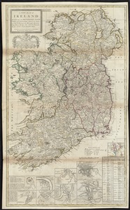
A new map of Ireland divided into its provinces, counties and baronies, wherein are distinguished the bishopricks, borroughs,...
98.
A new map of North America shewing its principal divisions, chief cities, townes, rivers, mountains &c
99.
A new map of the terraqueous globe according to the latest discoveries and most general divisions of it into continents and oceans
100.
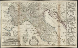
A new map of the upper part of Italy containing ye principality of Piemont ye Dutchies of Savoy, Milan, Parma, Mantua, Modena,...
‹ Prev
Next ›
1
2
![[A manuscript map of Isle Royalle]](https://bpldcassets.blob.core.windows.net/derivatives/images/commonwealth:hx11z507d/image_thumbnail_300.jpg)


![[Amerique septentrionale]](https://bpldcassets.blob.core.windows.net/derivatives/images/commonwealth:8336h2955/image_thumbnail_300.jpg)


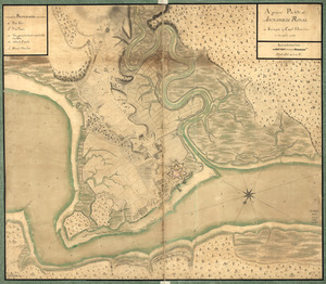
![Carte des découvertes qui ont été faites dans la partie occidentale du Canada sur les mémoires de Mr de la Varanderie [Vérendrye]](https://bpldcassets.blob.core.windows.net/derivatives/images/commonwealth:wp98ck41z/image_thumbnail_300.jpg)


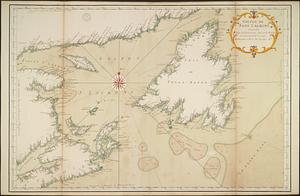
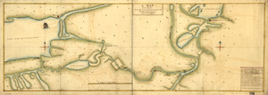
![[Entrance to the Harbour of S.t Johns Newfoundland]](https://bpldcassets.blob.core.windows.net/derivatives/images/commonwealth:6108vv35z/image_thumbnail_300.jpg)
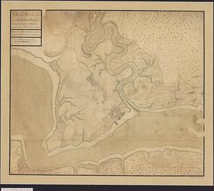
![Geographick scetch [sic], 1754](https://bpldcassets.blob.core.windows.net/derivatives/metadata/commonwealth-oai:pk02h894n/image_thumbnail_300.jpg)


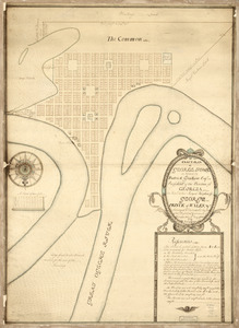
![[Land division survey of Duxbury and Pembroke, MA]](https://bpldcassets.blob.core.windows.net/derivatives/images/commonwealth:wd376285r/image_thumbnail_300.jpg)

![A map of lot no 4 in the [Ha]rdenbergh Patent](https://bpldcassets.blob.core.windows.net/derivatives/metadata/commonwealth-oai:zs262628v/image_thumbnail_300.jpg)


![[Map showing neck of land between 'Baye francaise' and 'Baye verte']](https://bpldcassets.blob.core.windows.net/derivatives/images/commonwealth:hx11z035j/image_thumbnail_300.jpg)
![[Map showing Saint John's Harbour and a proposed fort]](https://bpldcassets.blob.core.windows.net/derivatives/images/commonwealth:6108vw12v/image_thumbnail_300.jpg)
![[Map showing the location of Fort de la Presentation]](https://bpldcassets.blob.core.windows.net/derivatives/images/commonwealth:hx11z0993/image_thumbnail_300.jpg)