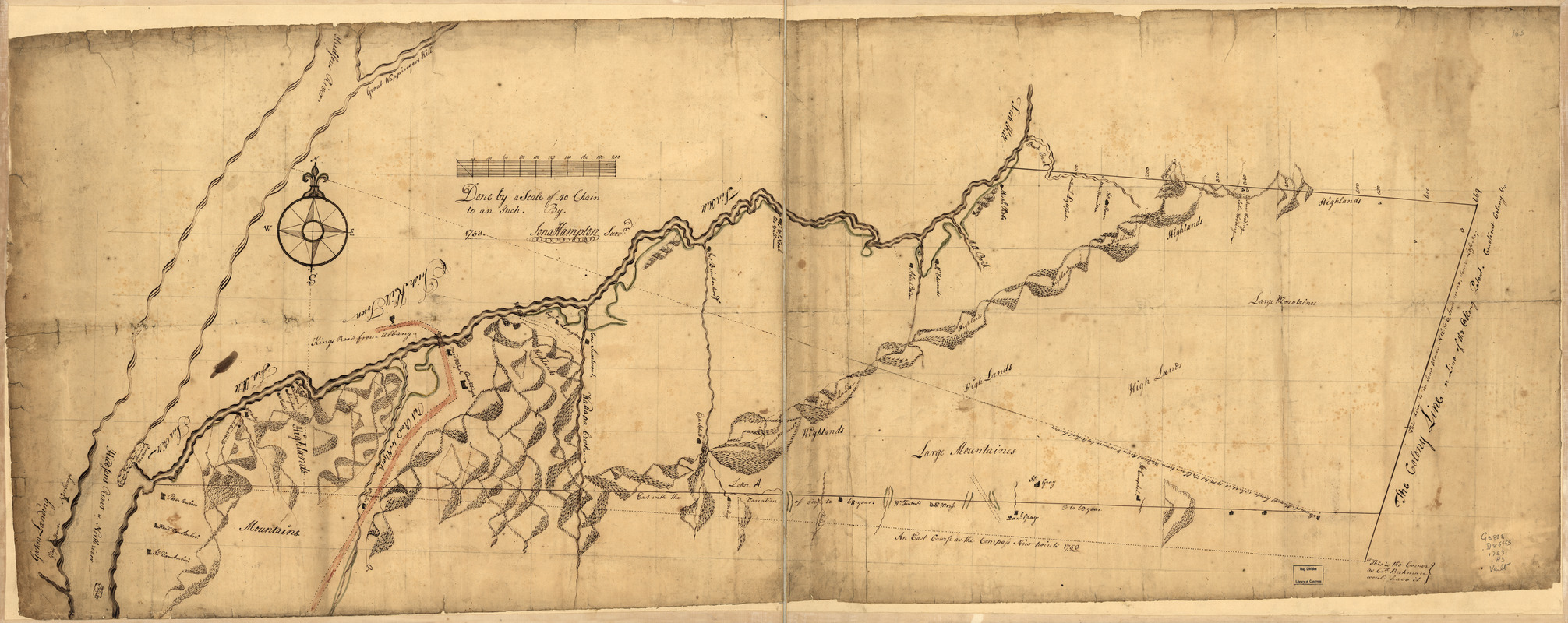
Draft of the lands disputed by Philipse Patent against Beekmans & Rambaults
This map is also available in American Revolutionary Geographies Online (ARGO), a collections portal especially built for material relating to the American Revolutionary War Era. Visit ARGO to learn more about this item and explore the historical geography of North America in the late eighteenth century.
Item Information
- Title:
- Draft of the lands disputed by Philipse Patent against Beekmans & Rambaults
- Creator:
- Hampton, Jona
- Date:
-
1753
- Format:
-
Maps/Atlases
Manuscripts
- Location:
- Library of Congress Geography and Map Division
- Collection (local):
-
Library of Congress Collection
- Subjects:
-
Land grants--New York (State)--Dutchess County--Maps--Early works to 1800
Real property--New York (State)--Dutchess County--Maps--Early works to 1800
Dutchess County (N.Y.)--Maps, Manuscript--Early works to 1800
Fishkill (N.Y.)--Maps, Manuscript--Early works to 1800
- Places:
-
Dutchess (county)Fishkill
- Extent:
- 1 manuscript map : hand color on sheet 54 x 140 cm.
- Terms of Use:
-
No known copyright restrictions.
This work is licensed for use under a Creative Commons Attribution Non-Commercial Share Alike License (CC BY-NC-SA).

- Scale:
-
Scale 1:31,680
- Language:
-
English
- Catalog Record:
-
https://lccn.loc.gov/gm71002312
- Notes:
-
Title from verso.
Alternate title from Philip Lee Phillips' A list of maps of America: [Map of Fishkill and vicinity]
Manuscript, pen-and-ink and watercolor.
Has watermark.
Relief shown pictorially.
Shows area in southern Dutchess County between the Hudson River and the Connecticut Colony line and shows designation of Fishkill Town.
- Notes (citation):
-
LC Maps of North America, 1750-1789, 1083
- Identifier:
-
ar108300z


