20 tracts, Charleston
This map is also available in American Revolutionary Geographies Online (ARGO), a collections portal especially built for material relating to the American Revolutionary War Era. Visit ARGO to learn more about this item and explore the historical geography of North America in the late eighteenth century.
Item Information
- Title:
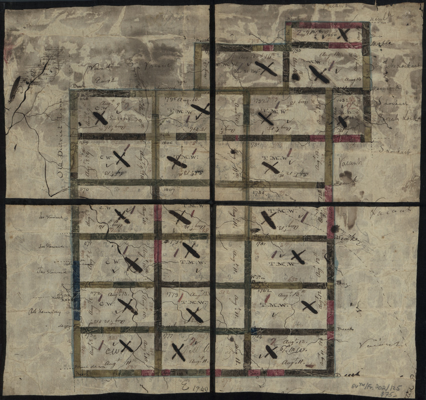
- 20 tracts, Charleston
- Title (alt.):
-
Twenty tracts, Charleston
- Creator:
- Adlum, John, 1759-1836
- Contributor:
- Bingham, William, 1752-1804
- Date:
-
[1790?–1799?]
- Format:
-
Maps/Atlases
Manuscripts
- Location:
- Library of Congress Geography and Map Division
- Collection (local):
-
Library of Congress Collection
- Subjects:
-
Real property--Pennsylvania--Charlestown (Township)--Maps--Early works to 1800
Boundaries (Estates)--Pennsylvania--Charlestown (Township)--Maps--Early works to 1800
Manuscript maps--Early works to 1800
Charlestown (Pa. : Township)--Maps--Early works to 1800
- Places:
-
Chester (county)Charlestown
- Extent:
- 1 map : ms., col., sectioned and mounted on cloth ; 34 x 36 cm., folded to 19 x 18 cm.
- Terms of Use:
-
No known copyright restrictions.
This work is licensed for use under a Creative Commons Attribution Non-Commercial Share Alike License (CC BY-NC-SA).

- Scale:
-
Scale [ca. 1:40,000]
- Language:
-
English
- Catalog Record:
-
https://lccn.loc.gov/86694770
- Notes:
-
Covers lands of the William Bingham estate surveyed by John Adlum in Charleston Township, Tioga County (Pa.).
Shows land ownership, lots, boundaries, numbers, and dimensions.
Title from label affixed to verso.
From the William Bingham estate maps.
Pen-and-ink and watercolor.
- Identifier:
-
la002163


