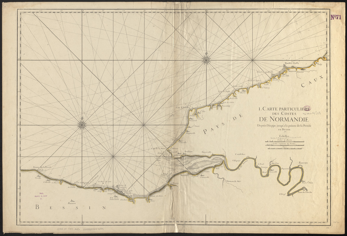
I. Carte particulière des costes de Normandie depuis Dieppe jusqu'à la Pointe Percée en Bessin
Item Information
- Title:
- I. Carte particulière des costes de Normandie depuis Dieppe jusqu'à la Pointe Percée en Bessin
- Date:
-
[1753]
- Format:
-
Maps/Atlases
- Location:
-
Boston Public Library
Norman B. Leventhal Map & Education Center - Collection (local):
-
Norman B. Leventhal Map & Education Center Collection
- Subjects:
-
Coasts--France--Normandy--Maps--Early works to 1800
Normandy (France)--Maps--Early works to 1800
- Places:
-
FranceNormandy (area)
- Extent:
- 1 map ; 57 x 84 cm
- Terms of Use:
-
No known copyright restrictions.
No known restrictions on use.
- Publisher:
-
[Place of publication not identified] :
[Publisher not identified]
- Scale:
-
Scale ca. 1:177,400
- Language:
-
French
- Notes:
-
Relief shown pictorially. Depths shown by soundings.
- Notes (date):
-
This date is inferred.
- Identifier:
-
06_01_006662
- Call #:
-
G5833.N7 1753 .A68x
- Barcode:
-
39999059027589