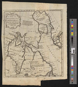
A map of Hudsons Bay and parts adjacent from the latest surveys and best authorities
This map is also available in American Revolutionary Geographies Online (ARGO), a collections portal especially built for material relating to the American Revolutionary War Era. Visit ARGO to learn more about this item and explore the historical geography of North America in the late eighteenth century.
Item Information
- Title:
- A map of Hudsons Bay and parts adjacent from the latest surveys and best authorities
- Creator:
- Jefferys, Thomas, -1771
- Name on Item:
-
T. Jefferys sculp.
- Date:
-
[1750]
- Format:
-
Maps/Atlases
- Location:
- William L. Clements Library
- Collection (local):
-
William L. Clements Library Collection
- Subjects:
-
Hudson Bay--Maps
- Places:
-
CanadaHudson Bay
- Extent:
- 1 map ; 24.8 x 21.8 cm.
- Terms of Use:
-
The University of Michigan Library provides access to these materials for educational and research purposes. These materials may be under copyright. If you decide to use any of these materials, you are responsible for making your own legal assessment and securing any necessary permission. If you have questions about the collection, please contact the William L. Clements Library.
Contact host institution for more information.
- Publisher:
-
[London] :
[Magazine of magazines]
- Scale:
-
Scale 1:13,000,000.
- Language:
-
English
- Catalog Record:
-
Catalog record
- Notes:
-
Published in: Magazine of magazines. Vol. 1, Sept. 1750, page 211.
- Notes (date):
-
This date is inferred.
- Identifier:
-
5506
- Barcode:
-
B4277691


