Toggle navigation
LMEC Home
Exhibitions
Georeferencing
Tools for Teachers
Collections
My Favorites
Sign Up / Log In
Search
Search the map portal
Map Collection
Map Collection
Map Sets
Search
Search
Search for
Search In
All Fields
Creator
Title
Subject
Place
Search All Digital Collections
Advanced Search
8329 Results
My Search
Start Over
More Like
commonwealth:h989r699w
Remove constraint More Like: commonwealth:h989r699w
Filter your Search
Place
North and Central America
5,078
United States
3,766
Suffolk (county)
1,188
Boston
1,161
Europe
963
Canada
427
Massachusetts
275
France
269
more
Place
»
Topic
Boston (Mass.)--Maps
740
United States--Maps
270
Real property--Massachusetts--Boston--Maps
194
Massachusetts--Maps
163
City planning--Massachusetts--Boston--Maps
154
Landowners--Massachusetts--Boston--Maps
141
North America--Maps--Early works to 1800
103
New England--Maps
101
more
Topic
»
Date
Date range begin
–
Date range end
Current results range from
1482
to
2023
View distribution
Creator
United States. Hydrographic Office
357
Boston Redevelopment Authority
160
O.H. Bailey & Co
148
Des Barres, Joseph F. W. (Joseph Frederick Wallet), 1722-1824
124
United States. Post Office Dept
120
Ptolemy, 2nd cent
100
Walling, Henry Francis, 1825-1888
94
Jefferys, Thomas, -1771
84
more
Creator
»
Format
Maps/Atlases
8,270
Manuscripts
215
Prints
51
Books
36
Objects/Artifacts
10
Drawings/Illustrations
8
Posters
4
Georeferenced
Yes
884
No
7,445
Collection
Norman B. Leventhal Map Center Collection
8,191
Boston and New England Maps
2,309
Urban Maps
2,044
Maritime Charts and Atlases
750
American Revolutionary War-Era Maps
638
Boston Redevelopment Authority Collection
190
Mapping Boston Collection
20
Massachusetts Real Estate Atlases
12
more
Collection
»
Available to use
No known restrictions
8,133
Creative Commons license
69
Search Constraints
Sort by date (desc)
relevance
title
date (asc)
date (desc)
Number of results to display per page
100 per page
10
per page
20
per page
50
per page
100
per page
View results as:
grid view
map view
Search Results
401.
USAF cloth chart, Western Mediterranean
402.
Armour food source map
403.
The Chevron trail through the scenic west
404.
Illustrierte karte der Vereinigten Staaten von Amerika : mit darstellung der regionalen bodenschätze, produkte und...
405.
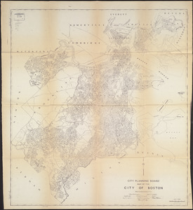
Maps from General plan for Boston : preliminary report, December, 1950
406.
Metropolitan Transit Authority system route map
407.
A Scott-Map of Boston, Massachusetts
408.
World freedom : a factual & pictorial map
409.
Atlas of town of Weymouth Massachusetts
410.
Gay days around America : a pleasure map of festivals, pageants, and special events best reached by Greyhound ... the...
411.
A map of the West Indies and the Spanish Main
412.
The pictorial map, United States stamps
413.
Storrow Memorial Embankment : plan of additions and changes under the requirements of Chapter 262, Acts of 1949
414.
A Texan's map of the United States [of Texas]
415.
These United States : products & industries
416.
United States inlay puzzle
417.
The 100th anniversary map of Abraham Lincoln's visit to Massachusetts, September 11-23, 1848
418.
Ask Shell!
419.
The Boston Globe ski map of northern New England and Canada
420.
Election map of the United States with 49 novel diagrams
421.
Map of the City of Boston, Massachusetts
422.
Map of the island of Tangerina and Wild Island
423.
Metropolitan Transit Authority system route map
424.
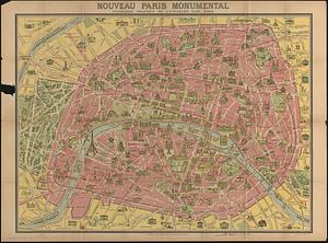
Nouveau Paris monumental : itinéraire pratique de l'etranger dans Paris
425.
The pictorial map, a world of stamps
426.
The pictorial map, stamps of America
427.
The pictorial map, stamps of the U.S.A.
428.
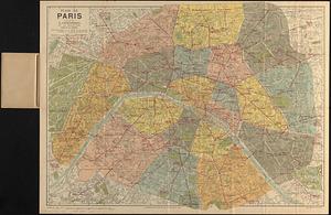
Plan de Paris divisé en 20 arrondissements et 80 quartiers
429.
Aaron Bohrod's America, its history
430.
Atlas of the city of Newton Massachusetts : assessors block system
431.
Boston Elevated Railway system route map
432.
Boston Elevated Railway track lengths of surface lines and subway
433.
Catholic America : a pictorial map portraying the contribution of Catholics in the development of the United States of America...
434.
Paul Sample's America, its soil
435.
Shíjú tú
436.
William Gropper's America, its folklore
437.
Bataan
438.
Camarines Sur : (western part)
439.
Cavite
440.
China, south coast, principal ethnic groups and dialects
441.
Germany, western border regions, agricultural areas (north of the Main and west of the Rhine Rivers)
442.
Germany western border regions rail traffic volume (excluding inter-Ruhr traffic) summer 1939
443.
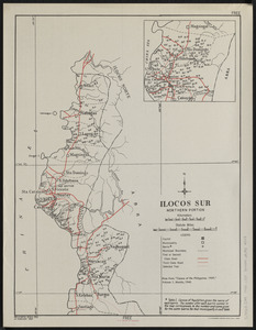
Ilocos Sur : northern portion
444.
Java and Madoera : Indonesian ethnic groups, elementary education, and Christian missions
445.
Java and Madoera principal estate regions showing major products
446.
Lesser Sunda Islands, distribution of population
447.
Lesser Sunda Islands Indonesian Ethnic groups and Christian missions
448.
Norddeutschland
449.
Pampanga
450.
Philippine Islands : [outline map]
451.
A pictorial map of North America
452.
Pictorial map of the American continent : featuring the Pan American Highway and showing some of the natural resources, scenic...
453.
Süddeutschland, Österreich, Schweiz und östliches Frankreich
454.
Sumatra wegenkaart
455.
Tayabas (northern part)
456.
Tayabas (southern part)
457.
Uprooted people of the U.S.A.
458.
Ward lines and voting precincts circa 1945
459.
Zambales
460.
The adventures of Mark Twain
461.
Atlas of town of Weymouth Massachusetts
462.
Caroline Islands, Yap Island
463.
China east coast population density
464.
Eight views of the world
465.
Germany, concentration camps (June--1944)
466.
Germany, postal administrative districts, March 1943
467.
Great Britain, her natural & industrial resources
468.
Indians of the U.S.A.
469.
Italy with Vatican City
470.
Mercator map of the world united : a pictorial history of transport and communications and paths to permanent peace
471.
Netherlands New Guinea : approximation of population distribution
472.
Northern Philippines land utilization
473.
Peace map of the world united : a pictorial history of transportation and communications from Jonah to the jet plane as paths...
474.
The story map of flying : being a chronicle of man's conquest of the air
475.
Town of Brookline, Mass. assessors' plans 1944
476.
World map of the major tropical diseases
477.
Algeria and Tunisia, port capacities and major transport routes
478.
Boston Elevated Railway system route map
479.
Global map for global war and global peace
480.
Great circle airways
481.
Invasion and total war victory maps : with decorations, illustrations and military and naval insignia
482.
Iraq water supply and land use
483.
Japan, the target : a pictorial Jap-map
484.
Newsmap : week of October 14 to October 21, 215th week of the war, 97th week of U.S. participation. Monday, October 25, 1943
485.
Newsmap : week of December 16 to December 22, 224th week of the war, 106th week of U.S. Participation. Monday, December 27, 1943
486.
A pictorial map of loveland
487.
Railroads of Lithuania, 1939
488.
Roads and communications of Sinkiang
489.
Town of Brookline Mass. Assessors' plans 1943
490.
Agricultural areas of China
491.
Boston Elevated Railway system route map
492.
The British Commonwealth of Nations
493.
China : waterways and stage routes
494.
French Morocco port traffic, 1938
495.
Germany, main movements of freight traffic
496.
Germany, main movements of freight traffic, 1942
497.
The good neighbor pictorial map of South America
498.
Japanese fishing, areas and seasons
499.
Land utilization in Korea
500.
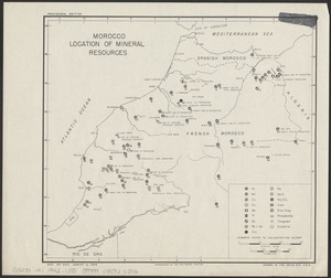
Morocco, location of mineral resources
‹ Prev
Next ›
1
2
3
4
5
6
7
8
9
…
83
84


![A Texan's map of the United States [of Texas]](https://bpldcassets.blob.core.windows.net/derivatives/images/commonwealth:fn107c388/image_thumbnail_300.jpg)