Land utilization in Korea
Item Information
- Title:
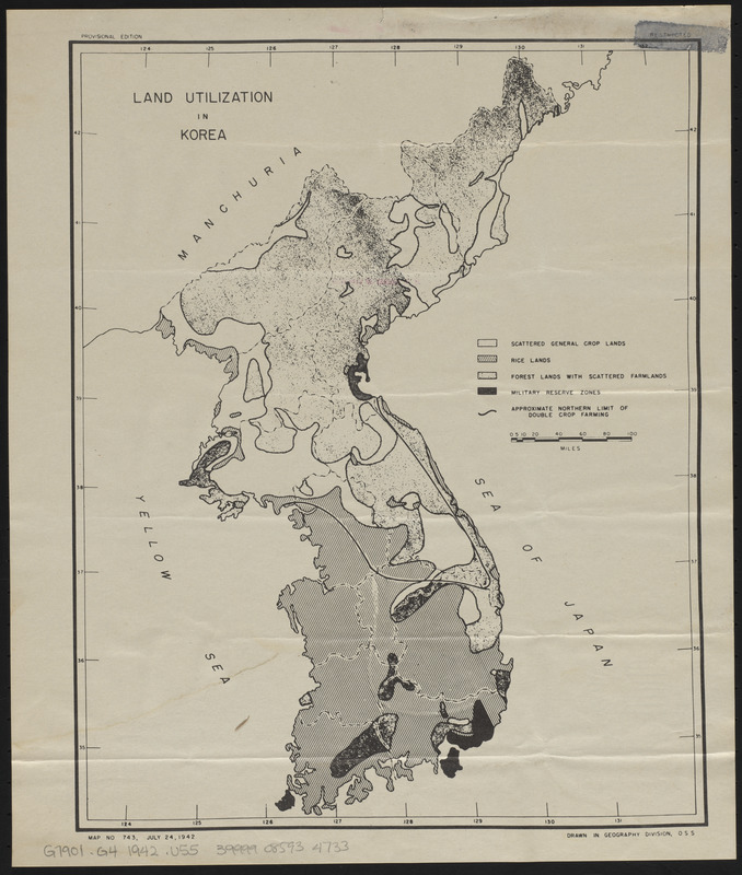
- Land utilization in Korea
- Cartographer:
- United States. Office of Strategic Services. Geography Division
- Name on Item:
-
drawn in Geography Division, OSS
- Date:
-
1942
- Format:
-
Maps/Atlases
- Location:
-
Boston Public Library
Norman B. Leventhal Map & Education Center - Collection (local):
-
Norman B. Leventhal Map & Education Center Collection
- Subjects:
-
Land use--Korea--Maps
Korea--Maps
- Places:
-
North Korea
South Korea
- Extent:
- 1 map ; 31 x 25 cm
- Terms of Use:
-
No known copyright restrictions.
No known restrictions on use.
- Publisher:
-
[Washington, D.C.?] :
[OSS]
- Scale:
-
Scale approximately 1:3,300,000
- Language:
-
English
- Notes:
-
Land use categories: scattered general crop lands, rice lands, forest lands with scattered farmlands, and military reserve zones.
"Map No. 743."
"July 24, 1942."
- Identifier:
-
06_01_015264
- Call #:
-
G7901.G4 1942 .U55
- Barcode:
-
39999085934733


