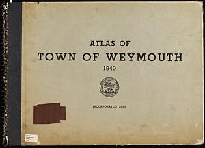
Atlas of town of Weymouth Massachusetts

Item Information
- Title:
- Atlas of town of Weymouth Massachusetts
- Cartographer:
- Whiting, Russell H.
- Publisher:
- Weymouth (Mass.). Public Works Department
- Name on Item:
-
surveyed and compiled by Russell H. Whiting, town engineer and registered land surveyor
- Date:
-
1944
- Format:
-
Maps/Atlases
- Location:
-
Boston Public Library
Norman B. Leventhal Map & Education Center - Collection (local):
-
Norman B. Leventhal Map & Education Center Collection
- Subjects:
-
Weymouth (Mass.)--Maps
Real property--Massachusetts--Weymouth--Maps
Landowners--Massachusetts--Weymouth--Maps
- Places:
-
MassachusettsNorfolk (county)Weymouth
- Extent:
- 1 atlas (8 unnumbered leaves, 65 leaves) : maps (some folded) ; 37 x 53 cm
- Terms of Use:
-
No known copyright restrictions.
No known restrictions on use.
- Publisher:
-
[Weymouth, Mass.] :
[Public Works Department]
- Scale:
-
Scale 1:2,400
- Language:
-
English
- Notes:
-
Shows plats, property owners and some buildings.
"Corrected to January 1, 1944."
Includes index maps and indexes.
- Identifier:
-
06_01_018615
- Call #:
-
G1234.W7 1944 .A85
- Barcode:
-
39999085968889