A map of the West Indies and the Spanish Main
Item Information
- Title:
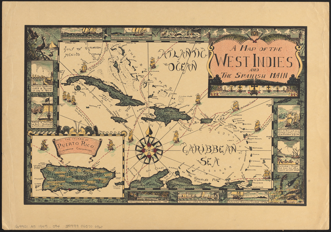
- A map of the West Indies and the Spanish Main
- Cartographer:
- Owen, Geoffrey (Cartographer)
- Name on Item:
-
Geoffrey Owen
- Date:
-
1949
- Format:
-
Maps/Atlases
- Location:
-
Boston Public Library
Norman B. Leventhal Map & Education Center - Collection (local):
-
Norman B. Leventhal Map & Education Center Collection
- Subjects:
-
West Indies--Maps
- Places:
-
West Indies
- Extent:
- 1 map : color ; 23 x 33 cm
- Terms of Use:
-
No known copyright restrictions.
No known restrictions on use.
- Publisher:
-
[Tortola, B.V.I.] :
Geoffrey Owen
- Scale:
-
Scale approximately 1:9,000,000
- Language:
-
English
- Notes:
-
Relief shown pictorially.
Border illustrated with scenes from around the West Indies.
Inset: The island of Puerto Rico, Caribbean crossroads.
- Identifier:
-
06_01_014783
- Call #:
-
G4901.A5 1949 .O94
- Barcode:
-
39999065706960


