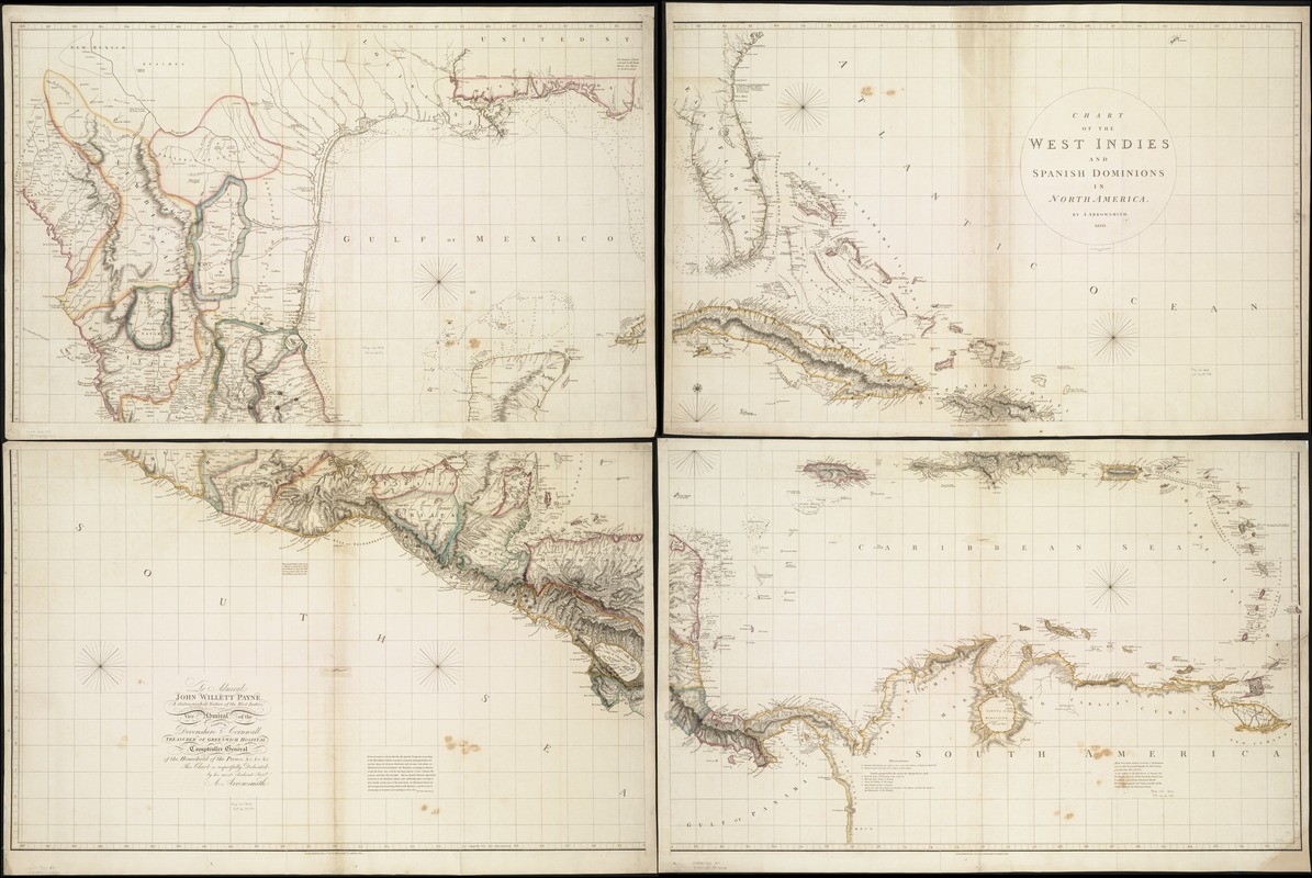
Chart of the West Indies and Spanish Dominions in North America
Item Information
- Title:
- Chart of the West Indies and Spanish Dominions in North America
- Creator:
- Arrowsmith, Aaron, 1750-1823
- Name on Item:
-
by A. Arrowsmith ; Jones, Smith & Co., sc. Beaufort Buildgs., Strand.
- Date:
-
1803
- Format:
-
Maps/Atlases
- Location:
-
Boston Public Library
Norman B. Leventhal Map & Education Center - Collection (local):
-
Norman B. Leventhal Map & Education Center Collection
- Subjects:
-
West Indies--Maps
Central America--Maps
Florida--Maps
- Places:
-
Florida
Mesoamerica (area)
West Indies
- Extent:
- 1 map on 4 sheets : hand col. ; 196 x 130 cm.
- Terms of Use:
-
No known copyright restrictions.
No known restrictions on use.
- Publisher:
-
London :
Published ... by A. Arrowsmith
- Scale:
-
Scale [ca. 1:2,780,000]
- Language:
-
English
- Notes:
-
Map shows West Indies, Florida, Central America, and northern part of South America.
Relief shown by hachures.
Depths shown by soundings.
Prime meridian: Greenwich.
Dedication: To Admiral John Willett Payne, a distinguished native of the West Indies ...
Featured in the Faces & Places Exhibit, Kravis Center, Palm Beach, FL, since 2005. MB (BRL)
- Identifier:
-
06_01_007869
- Barcode:
-
39999052507926


