The countries of the Caribbean : including Mexico, Central America, the West Indies and the Panama Canal
Item Information
- Title:
- The countries of the Caribbean : including Mexico, Central America, the West Indies and the Panama Canal
- Creator:
- National Geographic Society (U.S.). Cartographic Division
- Name on Item:
-
prepared especially for the National Geographic magazine.
- Date:
-
1922
- Format:
-
Maps/Atlases
- Location:
-
Boston Public Library
Norman B. Leventhal Map & Education Center - Collection (local):
-
Norman B. Leventhal Map & Education Center Collection
- Subjects:
-
Caribbean Area--Maps
Mexico--Maps
Central America--Maps
West Indies--Maps
Canal Zone--Maps
Guantánamo Bay (Cuba)--Maps
- Places:
-
Mexico
Mesoamerica (area)
PanamaCanal Zone (area)
CubaGuantánamo (province)Guantánamo, Bahía de (bay)
West Indies
Caribbean Sea
- Extent:
- 1 map : color ; 59 x 106 cm
- Terms of Use:
-
No known copyright restrictions.
No known restrictions on use.
- Publisher:
-
Washington, D.C. ; New York :
National Geographic Society, ; Redfield-Kendrick-Odell Co., Inc.
- Scale:
-
Scale 1:5,500,000 ;
- Language:
-
English
- Notes:
-
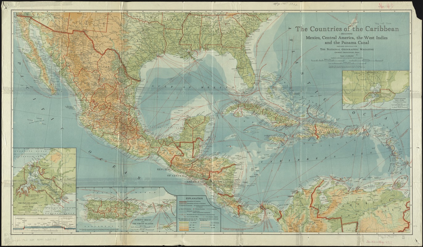
Relief shown by gradient tints and spot heights. Depths shown by gradient tints.
Insets: Guantanamo Bay, Cuba [approximately 1:400,000] -- Porto Rico and the Virgin Islands [approximately 1:1,300,000] -- The Panama Canal and the Canal Zone [and cross-section showing extent of canal excavation] [approximately 1:500,000].
- Identifier:
-
06_01_011891
- Call #:
-
G4390 1922 .N38
- Barcode:
-
39999065690081
- LCCN:
-
2009580146


