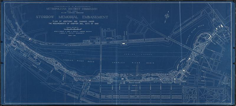
Storrow Memorial Embankment : plan of additions and changes under the requirements of Chapter 262, Acts of 1949
Item Information
- Title:
- Storrow Memorial Embankment : plan of additions and changes under the requirements of Chapter 262, Acts of 1949
- Cartographer:
- Shurcliff, Sidney Nichols, 1906-
- Cartographer:
- Shurcliff, Arthur A. (Arthur Asahel), 1870-1957
- Name on Item:
-
Arthur A. Shurcliff & Sidney N. Shurcliff, landscape architects
- Date:
-
1949
- Format:
-
Maps/Atlases
- Location:
-
Boston Public Library
Norman B. Leventhal Map & Education Center - Collection (local):
-
Norman B. Leventhal Map & Education Center Collection
- Subjects:
-
Charles River Esplanade (Boston, Mass.)--Planning--Maps
City planning--Massachusetts--Boston--Maps
- Places:
-
MassachusettsSuffolk (county)Boston
The Esplanade
- Extent:
- 1 map : blueprint, 76 x 171 cm
- Terms of Use:
-
No known copyright restrictions.
No known restrictions on use.
- Publisher:
-
[Boston, Massachusetts] :
Commonwealth of Massachusetts, Metropolitan District Commission, Parks Division
- Scale:
-
Scale 1:2,400. 1 in. = 200 ft
- Language:
-
English
- Notes:
-
Shows planned layout and features along the Charles River, from the Boston University Bridge to the Charles River Dam.
Oriented with north towards the upper right.
- Identifier:
-
06_01_017029
- Call #:
-
G3764.B6:2E8G45 1949 .S58
- Barcode:
-
39999085952867


