Invasion and total war victory maps : with decorations, illustrations and military and naval insignia
Item Information
- Title:
- Invasion and total war victory maps : with decorations, illustrations and military and naval insignia
- Title (alt.):
-
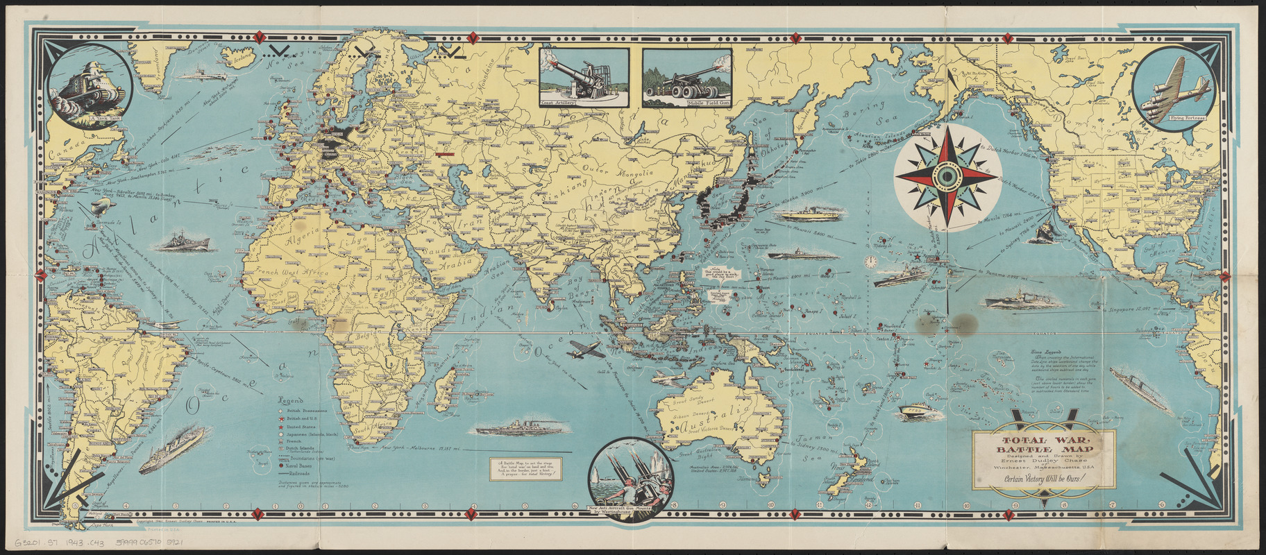
Total war battle map
Victory war map
- Creator:
- Chase, Ernest Dudley
- Artist:
- Chase, Ernest Dudley
- Cartographer:
- Chase, Ernest Dudley
- Publisher:
- Chase, Ernest Dudley
- Date:
-
1943
- Format:
-
Maps/Atlases
- Location:
-
Boston Public Library
Norman B. Leventhal Map & Education Center - Collection (local):
-
Norman B. Leventhal Map & Education Center Collection
- Subjects:
-
World War, 1939-1945--Maps
World maps
- Places:
-
World
- Extent:
- 4 maps on 1 sheet : both sides, color ; sheet 41 x 93 cm, folded to 21 x 12 cm
- Terms of Use:
-
No known copyright restrictions.
No known restrictions on use.
- Publisher:
-
Winchester, Massachusetts :
Ernest Dudley Chase
- Scale:
-
Scales differ
- Language:
-
English
- Table of Contents:
-
Total war battle map / designed and drawn by Ernest Dudley Chase
The victory war map / by Ernest Dudley Chase
[Southern England and Northern France]
[Italy and the Balkans].
- Notes:
-
Total war battle map includes illustrations of artillery and vehicles.
Victory war map includes illustrations of military insignia in border.
Panel title.
- Identifier:
-
06_01_014703
- Call #:
-
G3201.S7 1943 .C43
- Barcode:
-
39999065705921


