Maps from General plan for Boston : preliminary report, December, 1950


Item Information
- Title:
- Maps from General plan for Boston : preliminary report, December, 1950
- Title (alt.):
-
Preliminary general plan for Boston : areas for development
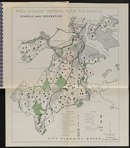
Preliminary general plan for Boston : schools and recreation
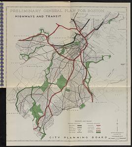
Preliminary general plan for Boston : highways and transit
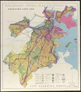
Preliminary general plan for Boston : proposed land use
- Cartographer:
- Boston (Mass.). City Planning Board
- Name on Item:
-
City Planning Board
- Date:
-
1950
- Format:
-
Maps/Atlases
- Location:
-
Boston Public Library
Norman B. Leventhal Map & Education Center - Collection (local):
-
Norman B. Leventhal Map & Education Center Collection
- Subjects:
-
Boston (Mass.)--Maps
City planning--Massachusetts--Boston--Maps
- Places:
-
MassachusettsSuffolk (county)Boston
- Extent:
- 4 maps : color ; on sheets 50 x 44 and 106 x 94 cm
- Terms of Use:
-
No known copyright restrictions.
No known restrictions on use.
- Publisher:
-
[Boston] :
City Planning Board
- Language:
-
English
- Catalog Record:
-
Accompanying text
- Notes:
-
3 maps on folded leaves and 1 folded map in back pocket.
- Identifier:
-
06_01_018538
- Call #:
-
HT168.B6 B67 1950
- Barcode:
-
39999065691741


