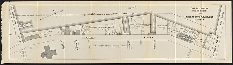
Charles River embankment, section A
Item Information
- Title:
- Charles River embankment, section A
- Issuing body:
- Boston (Mass.). Department of Parks
- Printer:
- Heliotype Printing Co.
- Date:
-
1880
- Format:
-
Maps/Atlases
- Location:
-
Boston Public Library
Norman B. Leventhal Map & Education Center - Collection (local):
-
Norman B. Leventhal Map & Education Center Collection
- Subjects:
-
Boston (Mass.)--Maps
Charles River Esplanade (Boston, Mass.)--Maps
City planning--Massachusetts--Boston--Maps
- Places:
-
MassachusettsSuffolk (county)Boston
- Extent:
- 1 map ; 19 x 74 cm
- Terms of Use:
-
No known copyright restrictions.
No known restrictions on use.
- Publisher:
-
[Boston] :
Park Department
- Scale:
-
Scale 1:960
- Language:
-
English
- Notes:
-
Partial cadastral map showing property areas and owners along the Charles River.
Shows also proposed harbor line.
Oriented with north toward the upper right.
In lower left margin: The Heliotype Printing Co.
Detached from Fifth annual report of the Board of Commissioners of the Department of Parks, for the city of Boston, for the year 1879 (Boston : Rockwell and Churchill, 1880).
- Identifier:
-
06_01_018783
- Call #:
-
G3764.B6:2E8G52 1880 .B6
- Barcode:
-
39999085969655


