[Mill dam survey : Boston, Roxbury, Brookline &c.]
Item Information
- Title:
- [Mill dam survey : Boston, Roxbury, Brookline &c.]
- Description:
-
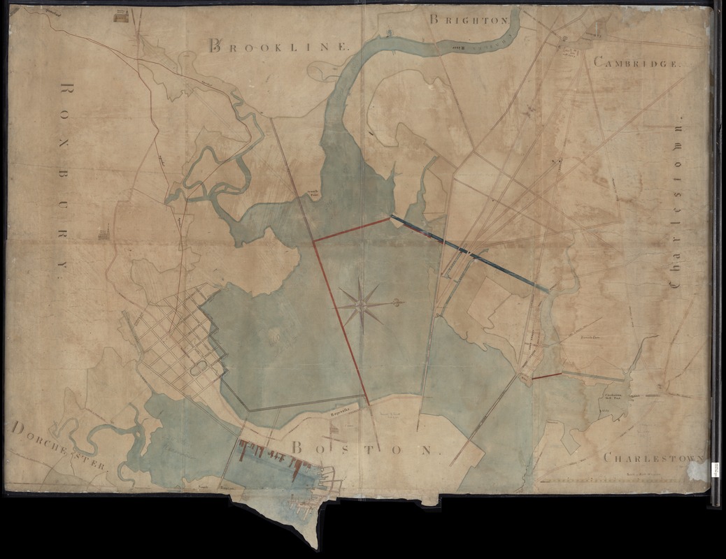
Manuscript map in ink and water-color of the Charles River area between Cambridge and Boston, covering parts of Boston, Charlestown, Cambridge, Brighton, Brookline, Roxbury and Dorchester. Shows marshy areas, reservoirs, aqueducts, streets, bridges, mills and wharves. Some buildings illustrated pictorially. Shows proposed bridges and boundaries, with notes in pencil.
- Date:
-
[1850?–1859?]
- Format:
-
Maps/Atlases
Manuscripts
- Location:
-
Boston Public Library
Norman B. Leventhal Map & Education Center - Collection (local):
-
Norman B. Leventhal Map & Education Center Collection
- Subjects:
-
Dams--Massachusetts--Boston--Maps
Fills (Earthwork)--Massachusetts--Boston--Maps
Land use--Massachusetts--Boston--Maps
City planning--Massachusetts--Boston--Maps
Boston (Mass.)--Maps
Cambridge (Mass.)--Maps
- Places:
-
MassachusettsSuffolk (county)Boston
MassachusettsMiddlesex (county)Cambridge
- Extent:
- 1 manuscript map : hand-colored ; 149 x 193 cm
- Terms of Use:
-
No known copyright restrictions.
No known restrictions on use.
- Scale:
-
Scale 1:3,960. Rods 20 to an inch
- Language:
-
English
- Notes:
-
Title in manuscript on piece of cloth attached to verso of map.
Oriented with north to the right.
- Identifier:
-
06_01_012299
- Call #:
-
G3764.B6G45 1850 .P76
- Barcode:
-
39999065697433


