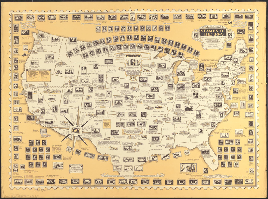
The pictorial map, stamps of the U.S.A.
Item Information
- Title:
- The pictorial map, stamps of the U.S.A.
- Title (alt.):
-
Stamps of the U.S.A.
- Artist:
- Chase, Ernest Dudley, 1878-1966
- Publisher:
- Chase, Ernest Dudley, 1878-1966
- Researcher:
- Kerr, Charles Peck
- Name on Item:
-
designed, drawn, and published by Ernest Dudley Chase ; research by Charles Peck Kerr
- Date:
-
1947
- Format:
-
Maps/Atlases
- Location:
-
Boston Public Library
Norman B. Leventhal Map & Education Center - Collection (local):
-
Norman B. Leventhal Map & Education Center Collection
- Subjects:
-
Stamp collecting--United States--Maps
United States--Maps
- Places:
-
United States
- Extent:
- 1 map : color ; 66 x 93 cm, on sheet 75 x 102 cm
- Terms of Use:
-
No known copyright restrictions.
No known restrictions on use.
- Publisher:
-
Winchester, Massachusetts :
Ernest Dudley Chase
- Scale:
-
Scale approximately 1:5,200,000
- Language:
-
English
- Notes:
-
Pictorial map.
Selected buildings shown pictorially.
Includes illustrations, list of "Postage firsts," and historical notes.
- Identifier:
-
06_01_014731
- Call #:
-
G3701.P8 1947 .C432
- Barcode:
-
39999065705681


