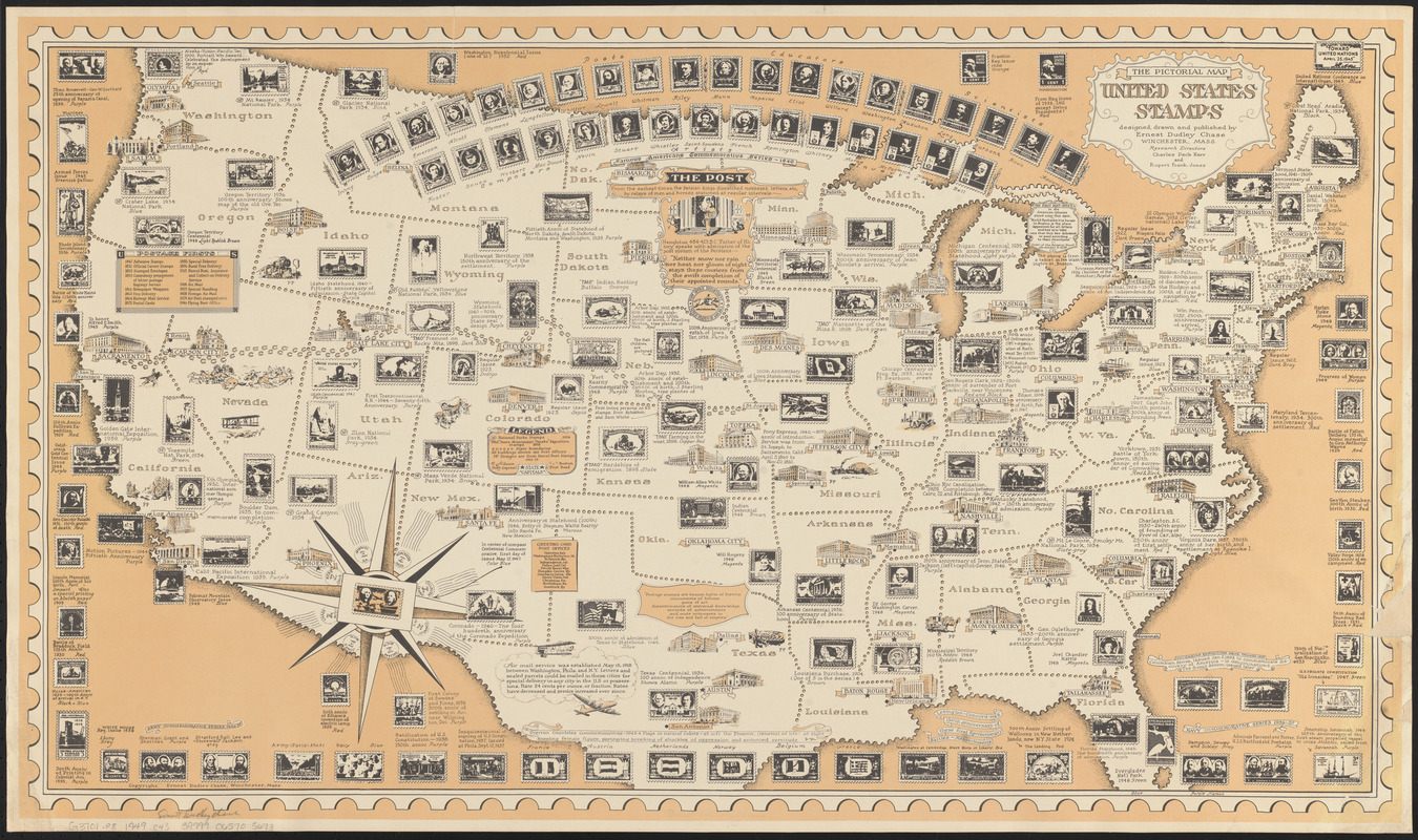
The pictorial map, United States stamps
Item Information
- Title:
- The pictorial map, United States stamps
- Title (alt.):
-
United States stamps
- Creator:
- Chase, Ernest Dudley, 1878-
- Artist:
- Chase, Ernest Dudley, 1878-
- Cartographer:
- Chase, Ernest Dudley, 1878-
- Publisher:
- Chase, Ernest Dudley, 1878-
- Researcher:
- Jones, Rupert Frank
- Researcher:
- Kerr, Charles Peck
- Name on Item:
-
designed, drawn, and published by Ernest Dudley Chase ; research directors, Charles Peck Kerr and Rupert Frank Jones
- Date:
-
[1949]
- Format:
-
Maps/Atlases
- Location:
-
Boston Public Library
Norman B. Leventhal Map & Education Center - Collection (local):
-
Norman B. Leventhal Map & Education Center Collection
- Subjects:
-
Stamp collecting--United States--Maps
United States--Maps
Pictorial maps
- Places:
-
United States
- Extent:
- 1 map : color ; 48 x 87 cm
- Terms of Use:
-
No known copyright restrictions.
No known restrictions on use.
- Publisher:
-
Winchester, Massachusetts :
Ernest Dudley Chase
- Scale:
-
Scale approximately 1:5,300,000
- Language:
-
English
- Notes:
-
Conservation of this piece was funded by Maureen O'Donnell in honor of Eugene E. O'Donnell.
Includes list of "Postage firsts" and historical notes.
- Notes (date):
-
This date is inferred.
- Identifier:
-
06_01_014730
- Call #:
-
G3701.P8 1949 .C43
- Barcode:
-
39999065705673


