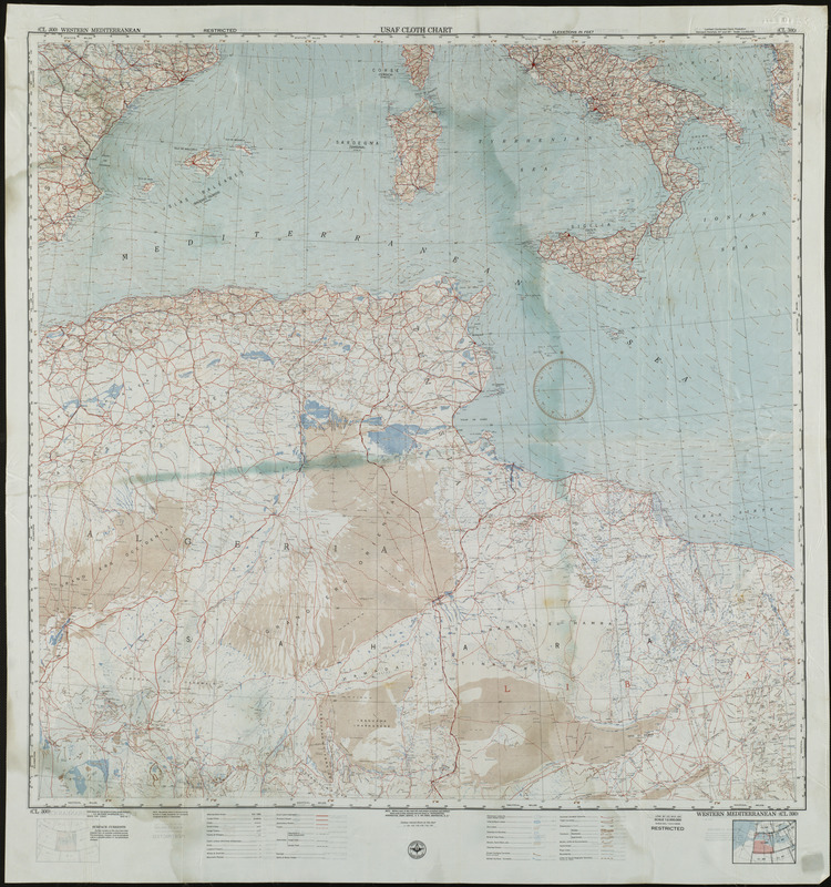
USAF cloth chart, Western Mediterranean
Item Information
- Title:
- USAF cloth chart, Western Mediterranean
- Cartographer:
- United States. Aeronautical Chart Service
- Date:
-
1951
- Format:
-
Maps/Atlases
- Location:
-
Boston Public Library
Norman B. Leventhal Map & Education Center - Collection (local):
-
Norman B. Leventhal Map & Education Center Collection
- Subjects:
-
Africa, North--Maps
Western Mediterranean--Maps
Military topography--Western Mediterranean--Maps
Europe, Southern--Maps
- Places:
-
North Africa (area)
Southern Europe (area)
Mediterranean Sea
- Extent:
- 1 map : color ; 91 x 91 cm
- Terms of Use:
-
No known copyright restrictions.
No known restrictions on use.
- Publisher:
-
Washington, D.C. :
Aeronautical Chart Service
- Scale:
-
Scale 1:2,000,000
- Language:
-
English
- Identifier:
-
06_01_004340
- Call #:
-
G5674.M4 1951 .U5
- Barcode:
-
39999059006302