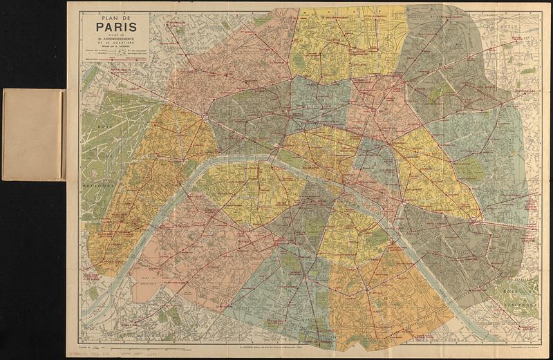
Plan de Paris divisé en 20 arrondissements et 80 quartiers
Item Information
- Title:
- Plan de Paris divisé en 20 arrondissements et 80 quartiers
- Title (alt.):
-
Paris au 1/17.500ème en 8 couleurs
Tracé complet des rue de Paris et du métropolitain
- Publisher:
- Editions A. Leconte
- Name on Item:
-
dressé par A. Leconte
- Date:
-
[1947–1952]
- Format:
-
Maps/Atlases
- Location:
-
Boston Public Library
Norman B. Leventhal Map & Education Center - Collection (local):
-
Norman B. Leventhal Map & Education Center Collection
- Subjects:
-
Paris (France)--Maps
Paris (France)--Description and travel
Subways--France--Paris--Maps
Streets--France--Paris--Maps
- Places:
-
FranceÎle-de-France (region)Paris
- Extent:
- 1 map : color ; 54 x 72 cm, folded in cover 15 x 10 cm + 1 map (color ; 13 x 17 cm)
- Terms of Use:
-
No known copyright restrictions.
No known restrictions on use.
- Publisher:
-
Paris :
A. Leconte
- Scale:
-
Scale approximately 1:17,500
- Language:
-
French
- Notes:
-
Date of publication estimated from subway system.
Indicates street address numbers at corners.
Attached to inside front cover of accompanying text is a map titled "Metropolitain" showing the subway system.
- Notes (date):
-
This date is inferred.
- Identifier:
-
06_01_017349
- Call #:
-
G5834.P3 1952 .E45
- Barcode:
-
39999085956389