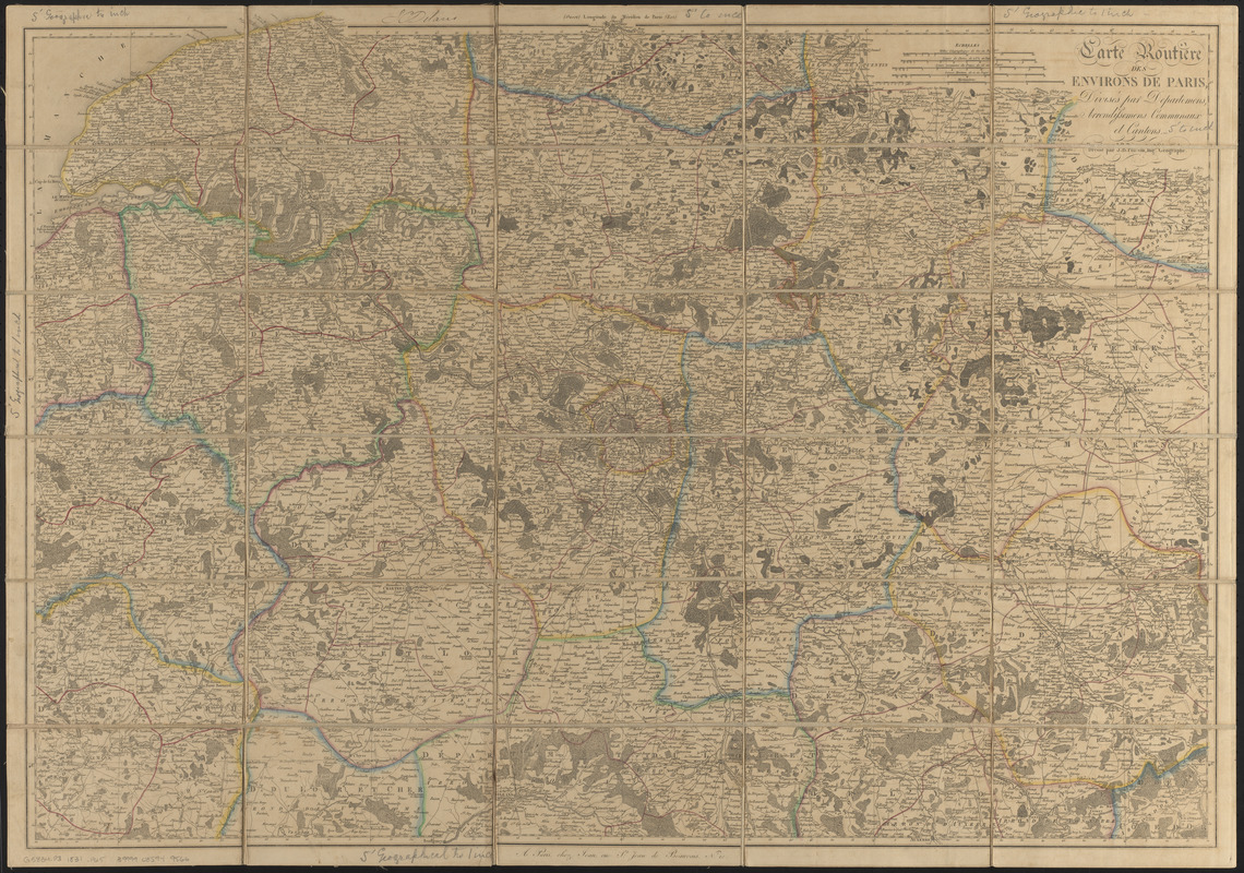
Carte routière des environs de Paris, divisés par departemens, arrondissemens communaux et cantons
Item Information
- Title:
- Carte routière des environs de Paris, divisés par departemens, arrondissemens communaux et cantons
- Cartographer:
- Poirson, J. B. (Jean Baptiste), 1760-1831
- Former owner:
- Schroeder, Alfred K., 1924-2001
- Name on Item:
-
dressé par J.B. Poirson, ingr. Géographe
- Date:
-
[ca. 1800–1831]
- Format:
-
Maps/Atlases
- Location:
-
Boston Public Library
Norman B. Leventhal Map & Education Center - Collection (local):
-
Norman B. Leventhal Map & Education Center Collection
- Subjects:
-
Paris (France)--Maps
Île-de-France (France)--Maps
- Places:
-
FranceÎle-de-France (region)Paris
- Extent:
- 1 map : hand color, sectioned and mounted on cloth ; 67 x 95 cm
- Terms of Use:
-
No known copyright restrictions.
No known restrictions on use.
- Publisher:
-
Paris :
chez Jean, rue St. Jean de Beauvais, no. 10
- Scale:
-
Scale approximately 1:363,000
- Language:
-
French
- Notes:
-
Prime meridian: Paris.
Manuscript ink in upper margin: J C Delano.
Gift of Massachusetts Department of Conservation and Recreation, from Alfred K. Schroeder's personal collection.
- Identifier:
-
06_01_016640
- Call #:
-
G5834.P3 1831 .P65
- Barcode:
-
39999085949566