Toggle navigation
LMEC Home
Exhibitions
Georeferencing
Tools for Teachers
Collections
My Favorites
Sign Up / Log In
Search
Search the map portal
Map Collection
Map Collection
Map Sets
Search
Search
Search for
Search In
All Fields
Creator
Title
Subject
Place
Search All Digital Collections
Advanced Search
8230 Results
My Search
Start Over
More Like
commonwealth:cj82kn81n
Remove constraint More Like: commonwealth:cj82kn81n
Filter your Search
Place
North and Central America
4,979
United States
3,802
Suffolk (county)
1,028
Boston
1,001
Europe
963
Canada
454
France
269
Massachusetts
264
more
Place
»
Topic
Boston (Mass.)--Maps
576
United States--Maps
282
Real property--Massachusetts--Boston--Maps
174
Massachusetts--Maps
163
Landowners--Massachusetts--Boston--Maps
132
New England--Maps
120
North America--Maps--Early works to 1800
103
New York (State)--Maps
81
more
Topic
»
Date
Date range begin
–
Date range end
Current results range from
1482
to
2023
View distribution
Creator
United States. Hydrographic Office
357
O.H. Bailey & Co
148
Des Barres, Joseph F. W. (Joseph Frederick Wallet), 1722-1824
123
United States. Post Office Dept
120
Ptolemy, 2nd cent
100
Walling, Henry Francis, 1825-1888
94
Jefferys, Thomas, -1771
84
Geological Survey (U.S.)
82
more
Creator
»
Format
Maps/Atlases
8,171
Manuscripts
217
Prints
51
Books
36
Objects/Artifacts
10
Drawings/Illustrations
8
Posters
4
Georeferenced
Yes
872
No
7,358
Collection
Norman B. Leventhal Map Center Collection
8,165
Boston and New England Maps
2,188
Urban Maps
1,925
Maritime Charts and Atlases
750
American Revolutionary War-Era Maps
676
Boston Redevelopment Authority Collection
86
William L. Clements Library Collection
32
American Antiquarian Society Collection
25
more
Collection
»
Available to use
No known restrictions
8,025
Creative Commons license
49
Search Constraints
Sort by relevance
relevance
title
date (asc)
date (desc)
Number of results to display per page
100 per page
10
per page
20
per page
50
per page
100
per page
View results as:
grid view
map view
Search Results
1.
Williams' telegraph and rail road map of the New England states, eastern protion of New York state and Canada : compiled from...
2.
Sherman & Smith's rail road, steam boat & stage route map of New England, New-York, and Canada
3.
Map exhibiting the rail road, canal, lake and river routes from New York and Boston to the west, via Ogdensburgh, Buffalo and...
4.
Map exhibiting the rail road routes leading from Boston, to Ogdensburg and Buffalo, N.Y
5.
Map of New England exhibiting the rail road & telegraphic lines now in operation
6.
Map of the Troy & Greenfield Rail Road and its connections
7.
Map showing the comparative merits, and benefits to Massachusetts, of the proposed extension of the New York and Massachusetts...
8.
Post route map of the states of New Hampshire, Vermont, Massachusetts, Rhode Island, Connecticut, and parts of New York and Maine
9.
Rail road map of New England & eastern New York
10.
Rail road map of New England & eastern New York
11.
Railroad map of New England & eastern New York complied from the most authentic sources
12.
A Map of that part of America which was the principal seat of war in 1756
13.
A new and accurate map of the present seat of war in North America
14.
Travel-map of New England
15.
Dinsmore's complete map of the railroads & canals in the United States & Canada
16.
Dinsmore's new railroad map of the United States and the Canadas, showing all the railroads completed and in progress,...
17.
General railway map engraved expressly for the Official guide of the railways and steam navigation lines of the United States,...
18.
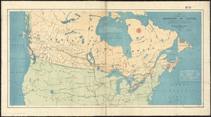
Map of the Dominion of Canada
19.
Map shewing the railways of Canada, to accompany annual report on railway statistics 1884
20.
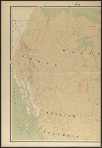
Map showing mounted police stations in north-western Canada
21.
Relief map of the Dominion of Canada
22.
Trans-continental map : showing the main lines and proposed extensions of the various trans-continental railroad systems of the...
23.
Hale's map of the central & western parts of Massachusetts, with a part of New-York
24.
Map of the eastern division and branches, Erie Railway
25.
Map of the several routes from Rochester to Buffalo : compiled from county maps and actual surveys in the office of the...
26.
Map of the State of New-York : showing its water and rail road lines, Jany. 1854
27.
Post route map of the State of New York and parts of Vermont, Massachusetts, Connecticut, New Jersey, and Pennsylvania also the...
28.
Post route map of the State of New York and parts of Vermont, Massachusetts, Connecticut, New Jersey, and Pennsylvania also the...
29.
Post route map of the state of New York showing post offices with the intermediate distances on mail routes in operation on the...
30.
Scarborough's new railroad, post office, township and county map of New York with distances between stations
31.
Transportation map of New York
32.
Map of the Hudson River & Berkshire R. R. and its connections
33.
New England and New York in 1697
34.
Rand McNally official 1920 auto trails map : District number 6 : New England, eastern New York
35.
ABC pathfinder railway guide map : eastern division
36.
Boston Clinton Fitchburg and Mansfield Framingham Lowell Railroads, and connections
37.
Ensign, Bridgman & Fanning's rail road map of the United States, showing the depots & stations
38.
G. Woolworth Colton's railroad, township & distance map of New England : with adjacent portions of New York, Canada & New...
39.
Lloyd's railroad, telegraph & express map of the Eastern States to accompany Lloyd's railroad, telegraph & express map of the...
40.
Map first division railway mail service
41.
Map of New England : with adjacent portions of New York & Canada
42.
Map of New England exhibiting the rail road and telegraphic lines now in operation
43.
Map of New England with adjacent portions of New York & Canada
44.
Map of New England with adjacent portions of New York & Canada
45.
Map of New England with adjacent portions of New York & Canada
46.
Map of the Boston & Maine Railroad, showing its relative position & connection with other railroads
47.
Map of the Boston and Northwestern, Massachusetts Central, and Boston and Poughkeepsie Railroads and their connections
48.
Map of the Boston, Concord, Montreal & White Mountains Railroad and its principal connections
49.
Map of the Eastern Railroad and principal connections
50.
Map of the Eastern Railroad and principal connections
51.
Map of the New York & Boston Railway, with its connections with other railways
52.
Map of the South Mountain and Boston Railroad & connections showing territory passed through, rail-roads and canals crossed or...
53.
A map of the Yearly Meeting of Friends for New England : 1850
54.
Map showing the lines of canals & rail roads owned, leased & operated by the Delaware and Hudson Canal and Rail Road Co. with...
55.
Map showing the proposed rail roads from Boston to Burlington, from Hale's map of New England
56.
National map of New England states Vermont, New Hampshire, Massachusetts, Connecticut, Rhode Island and Maine showing counties...
57.
New post office, township, county and railroad map of New England : with distances
58.
The New York, New Haven & Hartford Railroad and connections
59.
Post route map of the states of New Hampshire, Vermont, Massachusetts, Rhode Island, Connecticut, and parts of New York and Maine
60.
Post route map of the states of New Hampshire, Vermont, Massachusetts, Rhode Island, Connecticut, and parts of New York and Maine
61.
Post route map of the states of New Hampshire, Vermont, Massachusetts, Rhode Island, Connecticut and parts of New York and...
62.
Post route map of the states of New Hampshire, Vermont, Massachusetts, Rhode Island, Connecticut and parts of New York and...
63.
Post route map of the states of New Hampshire, Vermont, Massachusetts, Rhode Island, Connecticut and parts of New York and...
64.
Post route map of the states of New Hampshire, Vermont, Massachusetts, Rhode Island, Connecticut showing post offices with the...
65.
Railroad map of New England, with adjacent portions of New York & Canada
66.
Railway map of the New England states, engraved expressly for the Pathfinder railway guide
67.
Sketch of the states of Massachusetts, Connecticut, and Rhode Island, and parts of New Hampshire & New York exhibiting the...
68.
Sketch of the states of Massachusetts, Connecticut, and Rhode Island, and parts of New Hampshire & New York exhibiting the...
69.
Summer resorts of the coast, lake, and mountain regions along the Boston & Maine Railroad and connections
70.
Telegraph and rail road map of the New England states
71.
Williams' telegraph and rail road map of the New England states, eastern portion of New York state and Canada
72.
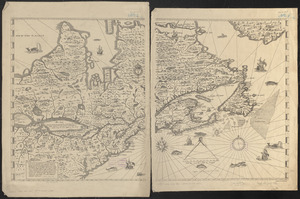
L'Isle de Terre-Neuve, l'Acadie, ou la Nouvelle Ecosse, : l'Isle St. Jean et la partie orientale du Canada
73.
A map of New England, and Nova Scotia; with part of New York, Canada, and New Britain & the adjacent islands of New Found Land...
74.
A new and accurate map of Quebec and its boundaries: from a late survey
75.
Carte de la Nouvelle Angleterre, Nouvelle Yorck, et Pensilvanie. : Pour servir à l'Histoire générale des voyages
76.
An Exact map of New England, New York, Pensylvania & New Jersey, : from the latest surveys
77.
A Map of New England & ye country adjacent, : extending northward to Quebec, & westward to Niagara, on Lake Ontario; shewing...
78.
This plan of Kennebeck & Sagadahock Rivers & country adjacent
79.
Old Colony & Newport railway and its connections
80.
Complete map of the rail roads and water courses in the United States & Canada
81.
Dinsmore's complete map of the railroads & canals in the United States & Canada
82.
Map of part of the Dominion of Canada, shewing location of some of the principal products, also railway & water routes
83.
Aboriginal map of North America, denoting the boundaries and the locations of various Indian tribes
84.
British America, comprehending Canada, Labrador, New-Foundland, Nova Scotia &c
85.
British possessions in North America
86.
The British possessions in North America from the best authorities
87.
The British possessions in North America from the best authorities
88.
Canada and Nova Scotia
89.
Canada and Nova Scotia
90.
Carte de la Nouvelle-France, augmentée depuis la derniere, servant a la navigation faicte en son vray Meridien par le Sr. de...
91.
Coal areas of Canada
92.
Dawson's map of the Dominion of Canada
93.
Dominion of Canada
94.
The Dominion of Canada from the latest surveys and data
95.
Government map of part of the Huron and Ottawa Territory, Ontario
96.
A Map exhibiting the frontiers of Canada and the United States : intended to illustrate the operations of the British &...
97.
A map of Canada
98.
Map of North America : showing all routes to Alaska and Klondike country
99.
A map of the province of Upper Canada, describing all the new settlements, townships, & cc. with the countries adjacent, from...
100.
Map of the provinces of upper & lower Canada with the adjacent parts of the United States of America, &c
‹ Prev
Next ›
1
2
3
4
5
…
82
83