New post office, township, county and railroad map of New England : with distances
Item Information
- Title:
- New post office, township, county and railroad map of New England : with distances
- Cover title :
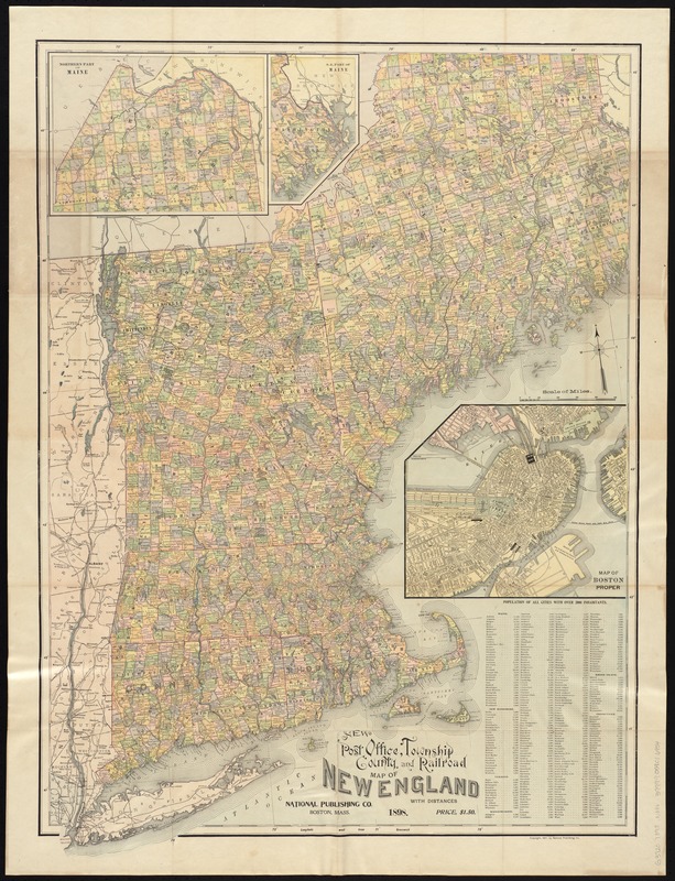
- Map of New England showing state, county & township boundaries, railroads, post offices & distances
- Creator:
- National Publishing Company (Boston, Mass.)
- Date:
-
1898
- Format:
-
Maps/Atlases
- Location:
-
Boston Public Library
Norman B. Leventhal Map & Education Center - Collection (local):
-
Norman B. Leventhal Map & Education Center Collection
- Subjects:
-
Railroads--New England--Maps
Post office buildings--New England--Maps
New England--Maps
- Places:
-
New England (area)
- Extent:
- 1 map : col. ; 88 x 64 cm.
- Terms of Use:
-
No known copyright restrictions.
No known restrictions on use.
- Publisher:
-
Boston :
National Publishing Co.
- Scale:
-
Scale ca. 1:760,320.
- Language:
-
English
- Notes:
-
Relief shown by hachures.
Oriented with north toward the upper left.
Insets: Map of Boston proper, Northern part of Maine, S.E. part of Maine.
Includes population of cities with over 2000 inhabitants.
- Identifier:
-
06_01_005749
- Call #:
-
G3720 1898 .N38x
- Barcode:
-
39999059016954


