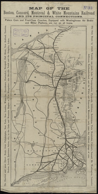
Map of the Boston, Concord, Montreal & White Mountains Railroad and its principal connections
Item Information
- Title:
- Map of the Boston, Concord, Montreal & White Mountains Railroad and its principal connections
- Title (alt.):
-
White Mountains by the Boston, Concord, Montreal and White Mountains R. R
- Creator:
- Rand, Avery & Co
- Date:
-
1882
- Format:
-
Maps/Atlases
- Location:
-
Boston Public Library
Norman B. Leventhal Map & Education Center - Collection (local):
-
Norman B. Leventhal Map & Education Center Collection
- Subjects:
-
Boston, Concord, Montreal, and White Mountains Railroad
Railroads--New England--Maps
New England--Maps
- Places:
-
New England (area)
- Extent:
- 1 map ; 60 x 28 cm., folded to 18 x 9 cm.
- Terms of Use:
-
No known copyright restrictions.
No known restrictions on use.
- Publisher:
-
Boston :
Rand, Avery & Co.
- Scale:
-
Scale [ca. 1:1,200,000]
- Language:
-
English
- Notes:
-
Relief shown by hachures.
Includes text in margins.
Text, ill., and timetables on verso.
- Identifier:
-
06_01_009214
- Call #:
-
G3721.P3 1882 .R36x
- Barcode:
-
39999065660621


