Lloyd's railroad, telegraph & express map of the Eastern States to accompany Lloyd's railroad, telegraph & express map of the United States & Canadas
Item Information
- Title:
- Lloyd's railroad, telegraph & express map of the Eastern States to accompany Lloyd's railroad, telegraph & express map of the United States & Canadas
- Creator:
- Lloyd, James T.
- Date:
-
1863
- Format:
-
Maps/Atlases
- Location:
-
Boston Public Library
Norman B. Leventhal Map & Education Center - Collection (local):
-
Norman B. Leventhal Map & Education Center Collection
- Subjects:
-
Railroads--New England--Maps
Telegraph lines--New England--Maps
New England--Maps
- Places:
-
New England (area)
- Extent:
- 1 map ; 96 x 66 cm.
- Terms of Use:
-
No known copyright restrictions.
No known restrictions on use.
- Publisher:
-
New York :
J. T. Lloyd
- Scale:
-
Scale [ca. 1:879,000]
- Language:
-
English
- Notes:
-
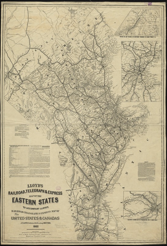
Oriented with north to the upper left.
Relief shown by hachures.
Insets: Riviere du Loup Branch, or northern terminus of Grand Trunk R. R. -- [Vicinity of Boston] -- Railways leading out of Philadelphia, on a large scale.
- Identifier:
-
06_01_009200
- Call #:
-
G3721.P3 1863 .L56x
- Barcode:
-
39999065660910


