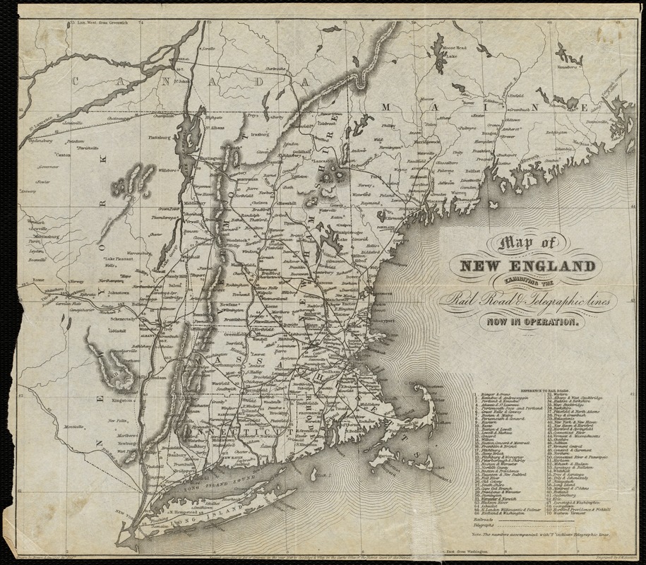
Map of New England exhibiting the rail road and telegraphic lines now in operation
Item Information
- Title:
- Map of New England exhibiting the rail road and telegraphic lines now in operation
- Title (alt.):
-
New map of Boston, comprising the whole city, with the new boundaries of the wards
- Creator:
- Boynton, George W., d. 1884
- Name on Item:
-
engraved by G.W. Boynton.
- Date:
-
1853
- Format:
-
Maps/Atlases
- Location:
-
Boston Public Library
Norman B. Leventhal Map & Education Center - Collection (local):
-
Norman B. Leventhal Map & Education Center Collection
- Subjects:
-
Railroads--New England--Maps
Telegraph lines--New England--Maps
New England--Maps
- Places:
-
New England (area)
- Extent:
- 1 map ; 25 x 28 cm.
- Terms of Use:
-
No known copyright restrictions.
No known restrictions on use.
- Publisher:
-
Boston, Mass :
[s.n.]
- Scale:
-
Scale not given.
- Language:
-
English
- Notes:
-
Includes reference to rail roads.
Prime meridians: Greenwich and Washington.
On verso: New map of Boston, comprising the whole city, with the new boundaries of the wards.
- Identifier:
-
06_01_005126
- Call #:
-
G3764.B6 1853 .B69
- Barcode:
-
39999059000511


