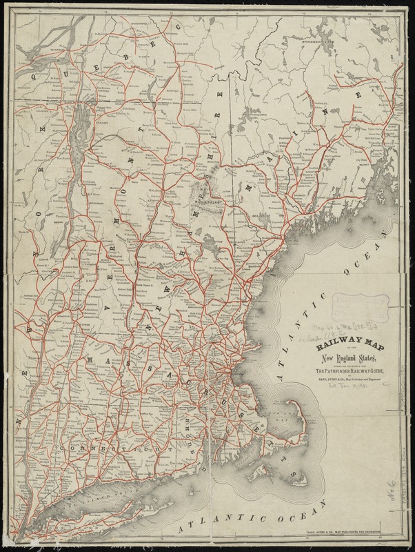
Railway map of the New England states, engraved expressly for the Pathfinder railway guide
Item Information
- Title:
- Railway map of the New England states, engraved expressly for the Pathfinder railway guide
- Creator:
- Rand, Avery & Co
- Name on Item:
-
by Rand, Avery & Co.
- Date:
-
[1870–1879]
- Format:
-
Maps/Atlases
- Location:
-
Boston Public Library
Norman B. Leventhal Map & Education Center - Collection (local):
-
Norman B. Leventhal Map & Education Center Collection
- Subjects:
-
Railroads--New England--Maps
New England--Maps
- Places:
-
New England (area)
- Extent:
- 1 map : col. ; 52 x 38 cm.
- Terms of Use:
-
No known copyright restrictions.
No known restrictions on use.
- Publisher:
-
[Boston] :
Rand, Avery & Co.
- Scale:
-
Scale [ca. 1:1,120,000]
- Language:
-
English
- Notes:
-
Covers also part of eastern New York and southern Québec.
Relief shown by hachures.
- Notes (date):
-
This date is inferred.
- Identifier:
-
06_01_009241
- Call #:
-
G3721.P3 1873 .R36x
- Barcode:
-
39999065660514


