Transportation map of New York
Item Information
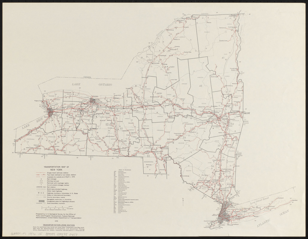
- Title:
- Transportation map of New York
- Cartographer:
- Geological Survey (U.S.)
- Publisher:
- United States. Federal Railroad Administration. Office of Policy and Program Development
- Name on Item:
-
prepared by U.S. Geological Survey for the Office of Policy and Program Development, Federal Railroad Administration, United States Department of Transportation
- Date:
-
1976
- Format:
-
Maps/Atlases
- Location:
-
Boston Public Library
Norman B. Leventhal Map & Education Center - Collection (local):
-
Norman B. Leventhal Map & Education Center Collection
- Subjects:
-
Transportation--New York (State)--Maps
Railroads--New York (State)--Maps
New York (State)--Maps
- Places:
-
New York
- Extent:
- 1 map : color ; 44 x 56 cm
- Terms of Use:
-
No known copyright restrictions.
No known restrictions on use.
- Publisher:
-
[Washington] ; Washington :
[Office of Policy and Program Development] ; Superintendent of Documents, U.S. Goverment Printing Office
- Edition:
- Transportation zone edition
- Scale:
-
Scale approximately 1:1,267,200. One inch represents approximately 20 miles
- Language:
-
English
- Notes:
-
Shows transportation zones, trackage rights, principal stations, distances between rail intersections, major U.S., interstate, and state highways, and navigable waterways.
Includes "Index to railroads."
- Identifier:
-
06_01_016705
- Call #:
-
G3801.P1 1976 .U5
- Barcode:
-
39999085950457


