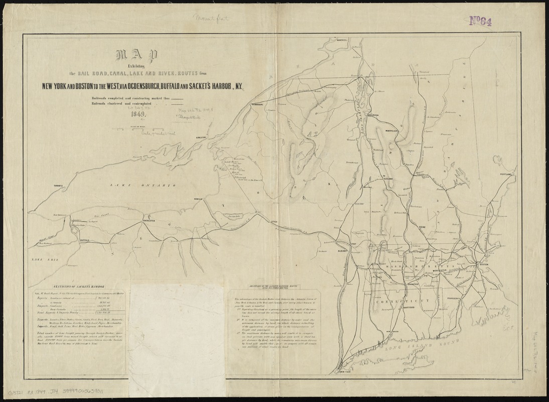
Map exhibiting the rail road, canal, lake and river routes from New York and Boston to the west, via Ogdensburgh, Buffalo and Sacket's Harbor, N.Y
Item Information
- Title:
- Map exhibiting the rail road, canal, lake and river routes from New York and Boston to the west, via Ogdensburgh, Buffalo and Sacket's Harbor, N.Y
- Creator:
- J.H. Bufford & Co
- Date:
-
1849
- Format:
-
Maps/Atlases
- Location:
-
Boston Public Library
Norman B. Leventhal Map & Education Center - Collection (local):
-
Norman B. Leventhal Map & Education Center Collection
- Subjects:
-
Railroads--New York (State)--Maps
Railroads--New England--Maps
New York (State)--Maps
New England--Maps
- Places:
-
New England (area)
New York
- Extent:
- 1 map ; 50 x 72 cm.
- Terms of Use:
-
No known copyright restrictions.
No known restrictions on use.
- Publisher:
-
Boston :
J.H. Bufford & Co. Lith.
- Scale:
-
Scale [ca. 1:1,150.000]
- Language:
-
English
- Notes:
-
Shows completed and proposed railroad lines.
Relief shown by hachures.
Includes statistics, table of distances, and "Advantages of the Sackets Harbor route."
Boston Public Library copy imperfect: Table of distances cut out.
- Identifier:
-
06_01_009158
- Call #:
-
G3721.P3 1849 .J14
- Barcode:
-
39999065659011


